History Blog
|
|
|
Editor's note: "Passages From The Diary Of A Transatlantic Traveller" was originally published as part of a series in The Leicester Chronicle (Leicester, England) on February 9, 1839. In this installment, our visiting Englishman is not particularly happy to be traveling aboard a packet boat on the Erie Canal. Read on for the full account. Many thanks to volunteer researcher George M. Thompson for finding and transcribing this historic newspaper article. 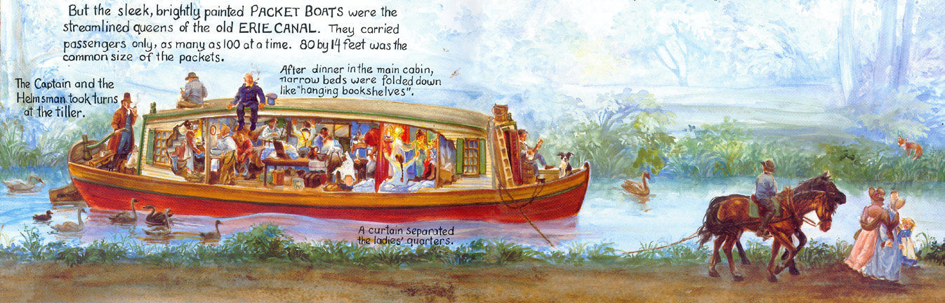 Painting by Cheryl Harness from her book "The Amazing, Impossible Erie Canal" (New York : Macmillan Books for Young Readers, c1995). The painting reveals a cross-section of an Erie Canal packet boat underway at night, with passengers getting ready for bed. April 24th. -- Sailed up the North River to Albany, passed West Point and the Highlands -- the day was raw and wet, and the mountain heights were wrapt in clouds, so that I viewed the scenery to a very great disadvantage. Took the railroad to Utica, and the canal-boat from thence to Buffalo; this was a long and tedious sail, but though I feared it would be disagreeable, I preferred it to riding in coaches, over bad roads, to the grievous prejudice of my bones. These packet boats go five miles and hour, and carry thirty, forty, or fifty passengers at a time. The ladies have a part of the cabin appropriated to themselves, which they can separate by merely drawing a curtain across if they choose. They have a further forward cabin for the night. I was struck with the singularity and ingenuity of our arrangements. About nine o'clock the steward rings a bell, when all the men turn out on deck; the sailors then sling up thirty or forty berths, to small hooks in the sides and roofs, and in an incredibly short time the whole cabin is converted into a sleeping apartment, and you are at liberty to turn in. Your berths are numbered, and you take one which corresponds to the number on your ticket. I was almost afraid to trust myself in one of them, but there being no alternative I laid myself on the shelf, with a Yankee lying in a berth above, and another in a berth below me. If the slight ropes which held up the Yankee above me had given way, I must infallibly have been crushed, and perhaps our accumulated weight would have crushed the poor fellow below, and subsequently some poor wight on the floor.  Photo of bunk beds, Erie Canal boat, by Sgerbic, Wikimedia Commons. I had sundry misgivings on this scene, which rather disinclined me to sleep, and the hot, nauseating, suffocating, stifling air, caused by the breathing of fifty human beings (for there were a dozen lying on the floor) in the small compass of a canal-boat, made me quite ready to turn out at an early hour, to go on deck and breathe. At five o'clock we were called up by sound of bell, "to scent the morning air." -- It, however, was miserably cold; so that between the close cabin, and the cold damp air of the deck, it was utterly impossible for any Christian man to avoid "cold and rheum, pthisic and catarrh." We were summoned at eight o'clock to breakfast, dined at one, supped at six, and were slung up in our hammock again at nine. This I endured for three days: it was not very pleasant, but I doubt whether it is possible to make canal-boats agreeable under any circumstances; travelling in this way must necessarily be tedious at the best. The last morning on coming on deck, the opposite shore of a rapid river along which we were sailing was pointed out, with a remark, that that was a part of her Majesty's dominions. As it was the first time I had ever seen her transatlantic colonies, I necessarily regarded them with considerable interest: there was nothing, however, different in point of appearance from the general features of the country I had seen for the last few days: I intend to see Canada more in detail in the course of another week. Poor Englishman! That Canada looked just like New York! How disappointing. He just doesn't seem to have the right attitude for travel, does he?
If you enjoyed this post and would like to support more history blog content, please make a donation to the Hudson River Maritime Museum or become a member today!
0 Comments
Editor's Note: The following text is a verbatim transcription of an article written by George W. Murdock, for the Kingston (NY) Daily Freeman newspaper in the 1930s. Murdock, a veteran marine engineer, wrote a regular column. Articles transcribed by HRMM volunteer Adam Kaplan. 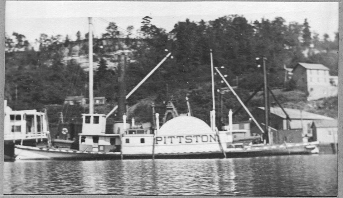 The towing steamer "Pittston" at the cement work docks in Rondout Creek, undated. Donald C. Ringwald Collection, Hudson River Maritime Museum. Most of the steamboats built during the period before the Civil War were originally passenger vessels, and it was only in the later years of their service that they were rebuilt for towing purposes. Not so with the steamboat “Pittston”- she was one of the few sidewheel vessels built purposely for towing on the Hudson river, and she was in use for 57 years, hauling heavily laden barges on the river. The wooden hull of the “Pittston” was built at New York in 1852. She was 108 feet long, breadth of beam 20 feet, depth of hold six feet, and her gross tonnage was rated at 74 with net tonnage at 58. The Allaire Iron Works of New York built her vertical beam engine which had a cylinder diameter of 32 inches with an eight foot stroke. The “Pittston” was constructed for the Pennsylvania Coal Company and was considered one of the finest vessels of her type to appear on the Hudson river. During this period the offices and yards of the Pennsylvania Coal Company were located at Port Ewen and the towboat “Pittston” was placed in service towing canal boats off the Delaware and Hudson Canal from Eddyville to Port Ewen. She was under the command of Captain Thomas Murry with James Mollin as chief engineer, and she continued on this route for a period of 13 years.  Unidentified Cornell tugboat (far left) and towing steamer "Pittston" (center left) tandem towing two passenger barges, the "Empress" and "J. R. Baldwin." Donald C. Ringwald Collection, Hudson River Maritime Museum. In 1865 the Pennsylvania Coal Company moved its headquarters to Newburgh and the towboat “Pittston” was purchased by Thomas Cornell of Rondout. For the following five years the “Pittston” towed out of Rondout along the river to various ports, and in 1871 she was placed in regular service between Rondout and the city of Hudson. A year later, 1872, found the “Pittston” in service on the route between Rondout and Newburgh, towing in line with the towboats “Frank Carter,” “Ceres” and later the “Isaac M. North” of the Cornell Line. The crew of the “Pittston” during the years of the Newburgh run are listed as captain, William Roberts; pilots, Wash Saulpaugh and Joel Rightmyer; chief engineer, James Purdy. In the year 1875 the “Pittston” was withdrawn from the Newburgh route and placed in service between Rondout and Eddyville on the Rondout creek, taking the place of the steamboat “Maurice Wurtz” which had been towing on this route since 1857. The “Pittston” was used for towing the canal barges of the Delaware and Hudson Coal Company from tidewater at Eddyville to Rondout and she was under the command of Captain George E. Dubois, with Alonzo Woolsey as chief engineer. The “grand old days of the Delaware and Hudson Canal” came to a close in 1898 when the canal was abandoned, and the towboat Pittston” was then used around the Rondout harbor and as a helper for tows on the river. In September 1909 the “Pittston” was found to be in an advanced state of wear, and she was sold and broken up after 57 years of continuous service as a towboat. AuthorGeorge W. Murdock, (b. 1853-d. 1940) was a veteran marine engineer who served on the steamboats "Utica", "Sunnyside", "City of Troy", and "Mary Powell". He also helped dismantle engines in scrapped steamboats in the winter months and later in his career worked as an engineer at the brickyards in Port Ewen. In 1883 he moved to Brooklyn, NY and operated several private yachts. He ended his career working in power houses in the outer boroughs of New York City. His mother Catherine Murdock was the keeper of the Rondout Lighthouse for 50 years. The Pittston is one of many wrecked and abandoned boats in and around the Rondout Creek. To learn more about shipwrecks and other vessels, take one of our new Shipwreck Tours aboard our 100% solar-powered tour boat Solaris! If you enjoyed this post and would like to support more history blog content, please make a donation to the Hudson River Maritime Museum or become a member today!
Editor's Note: This account, "Wheeling on a Towpath," was originally published in the New-York Tribune on August 20, 1899. Many thanks to HRMM volunteer researcher George A. Thompson for finding and transcribing this article. 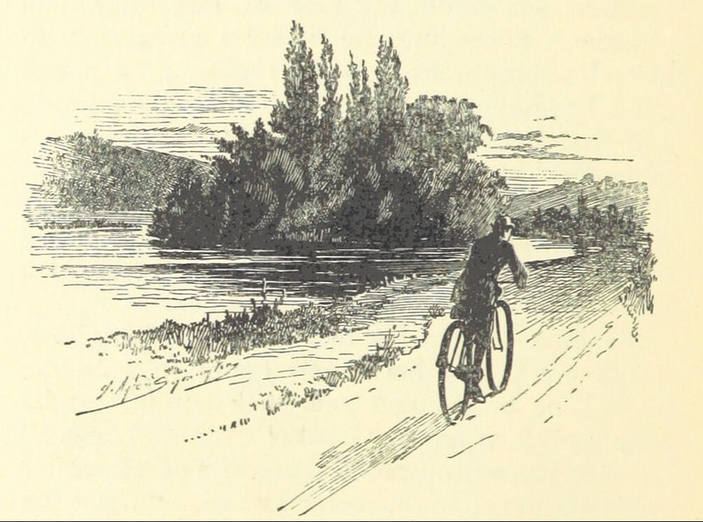 Image from, "The Wheels of Chance. A holiday adventure, etc", "Single Works" by H.G. Wells, 1896. Wheeling on a Towpath: A Picturesque Tour Along the Delaware and Hudson Canal. The old Delaware and Hudson Canal, in its wanderings from Rondout, on the Hudson, to Honesdale, on the Lackawaxen, passes through some of the most picturesque and interesting country of any that lies near New-York. More than half a century ago Washington Irving wrote: Honesdale, August 1, 1841. My Dear Sister: I write from among the mountains in the upper part of Pennsylvania, from a pretty village which has recently sprung into existence as a deposit of a great coal region, and is called after our friend Philip Hone. I came here along the Delaware and Hudson Canal, which extends from the Hudson River, near the Catskill Mountains, upwards of a hundred miles into the interior, traversing some of the most beautiful parts (as to scenery) of the State of New-York and penetrating the State of Pennsylvania. I accompanied the directors of the Delaware and Hudson Canal in their annual visit of examination. I do not know when I have made a more gratifying excursion with respect to natural scenery or more interesting from the stupendous works of art. The canal is laid a great part of the way along the romantic valleys watered by the Rondout, Delaware and Lackawaxen. For many miles it is built along the face of perpendicular precipices rising into stupendous cliffs with overhanging forests, or jutting out into vast promontories; while on the other side you look down upon the foot of an immense wall or embankment which supports the canal. Altogether, it is one of the most daring undertakings I have ever witnessed to carry an artificial river over rocky mountains and up the most savage and almost impracticable defiles. For upwards of ninety miles I went through a constant succession of scenery that would have been famous had it existed in any part of Europe; the Catskill Mountains to the north, the Shawangunk Mountains to the south, and between them, lovely valleys, with the most luxuriant woodlands and picturesque streams. All this is a region of which I have heard nothing -- a region entirely unknown to fame; but so it is in our country. We have some main routes for the fashionable traveller, along which he is hurried in steamboats and railroad cars, while on every side extend regions of beauty about which he hears and knows nothing. Some of the most enchanting scenes I have beheld since my return to the United States have been in out of the way places into which I have been accidentally led.  "Port Ben, Delaware and Hudson Canal," by Theodore Robinson, 1893. Pennsylvania Academy of Fine Arts. THE SCENERY UNCHANGED. History does not say whether Washington Irving ever rode a wheels. If he did it must have been of the ancient velocipede variety, which had more novelty than pleasure in it. But the scenery which called forth his admiration from the deck of the directors' special boat has changed but little to-day, and the wheelman an see and do in two days what probably took Irving five or six. The ride along the canal path is an ideal one for the wheelman, and it is rather strange that it is not more known to the touring wheelman. The riders of the immediate neighborhood use the towpath constantly to get from place to place along its banks, but the wheel with baggage roll or baggage carrier strapped upon its frame, showing the rider to be a tourist from a distance, is a rarity. It is an ideal route for touring, as it takes the rider by rolling farmlands and quiet meadows through mountain passes and rugged forests, along babbling brooks, placid ponds and tumultuous dashing rivers, and yet there is not a hill to push up, for it is all on the level. It has all the advantages that can be obtained in wheeling through a beautiful mountainous country, without any of the disadvantages of hill climbing and rough roads. Probably the principal reason why the path has not been more popular and better known to the touring wheelman is that the canal company was supposed to have prohibited wheeling, and at many of the lockhouses are signs warning wheelmen that a $5 fine will be the penalty for riding on the path. But the law has been practically a dead letter, and the writer, who has ridden the path for three years, never heard of its being enforced. Now that the canal has practically been abandoned, and the patient mule, which his melodious voice and his playful habit of kicking at a wheel, is a thing of the past, there is no longer any reason for riders not to visit this wild and romantic region. The canal is something less than 120 miles long. While, of course, it can be easily done in a couple of days, or even in a day, if the rider rides à la Murphy or Taylor, still, a congenial party of three or four can make a most delightful holiday of it by taking a week or ten days to it, that is, if the entire trip from the city and back is made awheel, going up the Hudson to Rondout and doubling back from the coal fields to Port Jervis (better make that stretch by rail), and then south by the Milford [illegible] to the Water Gap and toward the city again, down and through the mountains of Northern New-Jersey. Such a holiday party should not neglect to strap a rod or two to wheels, as the numerous rivers which are feeders to the canal are noted for their bass, trout and perch. As a generous appetite generally waits on the wheelman, a mess of fish fresh from the stream will add much to the bill of fare if the wheelman has to tarry overnight with some obliging farmer. 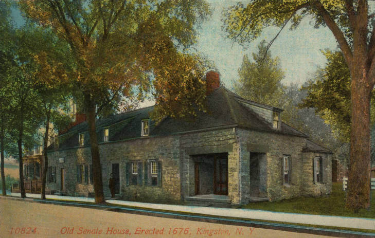 "Old Senate House, erected 1676, Kingston, N.Y." historic postcard, Friends of Historic Kingston. THE BEST ROUTE TO RONDOUT As most riders are familiar with the roads on both sides of the Hudson to Rondout this part of the trip need not be dwelt upon. Suffice it to say that the easiest and best way north is up the Saddle River Valley from Hackensack, to Suffern, thence up the Ramapo Valley to Newburg, crossing the Hudson to Fishkill, and continuing on the east bank to Rhinebeck. Then go by ferry over the river again. After all that is said about bicycling along the shores of the Hudson, the roads are poor and the hills hard north of Tarrytown, and only in a few places are the river views within sight to repay for the labor and discomfort of poor "going." The Hackensack-Suffern-Newburg route is trustworthy, and the roads are uniformly excellent. At Kingston, a quiet spin may be made around the ancient capital of the State. The State House is still in existence, also several other old buildings whose history might be interesting to look up. In the cemetery of the old church are buried several heroes of the Revolutionary War. Rondout, the eastern terminus of the canal, is now politically part of the city of Kingston. While it is not a particularly attractive town in any way, it is a busy one, being the river shipping point of several important industries. A dusty and not very attractive road leads out of Rondout, following the river of the same name under the shadow of Fly Mountain to the canal basin at Eddyville, where the enormous tows or collections of canal boats were formerly gathered for the trip to the city. The towpath proper begins here, passing several small groups of houses at the locks. Rosendale of cement fame, is the first and the only important town for fifty miles. Out in the open country, beyond Rosendale, the fascination of the canal path riding begins. As there are no hills or grades to be overcome, the rider can reserve his strength for the distance he has planned to do. The surface is always fair, and at times excellent; even when fresh gravel has been placed on the path there is generally a footpath worn by the motor power of the canal. The drawbacks for wheeling are the numerous locks, there being more than fifty between tidewater and the Delaware River. Sometimes they are frequent, nine of them in one section of two miles; at others they are miles apart: as at Summit there is a seventeen-mile level, and further on a ten-mile level. The approaches to the locks are comparatively easy, and the ten or fifteen feet rises can usually be "rushed." It is seldom the rider is forced to dismount, but when they come half a dozen to the mile they get monotonous, and the rider is apt to discover something interesting in connection with the lock, which will give him an excuse to dismount and inspect it. A WIND THROUGH THE HILLS. The canal is seldom straight for more than half a mile. It constantly follows the twists and turns at the foot of the Shawangunk range of hills. The vistas which are constantly opening before the wheelman are delightful. On one side of the narrow towpath is the placid canal, and on the other the Rondout Creek, sometimes a rushing mountain stream, and at others widened out into a small lake. On the south the Shawangunk (pronounced Shongum) Mountains follow the canal to Port Jervis, with the hotels at Mohawk, Minnewaska, Mount Meenahga and other places perched high above. To the north are the Catskill Mountains, with their summer hotels and sky-perched villages. Bold Slide and other prominent mountains are land marks until the day's trip is nearly over. The flora is particularly varied and abundant. Wild roses, daisies, black-eyed Susans, loose-strife, convolvulus and other make patches of color, which are reflected many times in the canal and river. The canal seems to be specially attractive to may forms of animal and bird life. Rabbits, squirrels and chipmunks are constantly dashing across the path and flitting among the bushes and trees, or flying overhead are innumerable flocks of spike-tailed swallows, brilliant orioles, indigo birds, robins, yellow birds, jays, cuckoos, red winged blackbirds and pugnacious king birds, chasing their hereditary enemies, the crows. Off the mountains sometimes an enormous hawk or eagle may be seen. The sharp, shrill cry of the catbird and the cheerful bobwhite, and toward dusk the call of the whip-poor-will may be heard. In the sixty miles between Rondout and Port Jervis there are only a few small towns. Rosendale, Napanock, Ellenville, Wortzboro and Cuddabackville are the principal places. They all have fairly comfortable hotels and bicycles shops, where repairs can be attended to. At Ellenville the activity on the canal ceases as the Delaware and Hudson company no longer ships coal by boat. The eastern end is at present kept open to accommodate the stone industries, but at no distant date the entire waterway will be abandoned, and a railroad will probably take its place. In the mean time the League of American Wheelmen and others are taking steps to make the towpath a permanent bicycle path. Today, many former canal towpaths and railroads (some of which were originally canal towpaths) are being converted into rail trails and bike paths. If you would like to bike the Empire State Trail, try the Hudson Valley Greenway Trail, including the Kingston, NY portion that goes right by the Hudson River Maritime Museum!
If you enjoyed this post and would like to support more history blog content, please make a donation to the Hudson River Maritime Museum or become a member today! Editor’s Note: Welcome to the final episode in our 11-part account of Muddy Paddle's narrowboat trip through the Erie Canal and the Cayuga & Seneca Canal in western New York. The New York State Barge Canal system is in many ways a tributary of the Hudson River. It still connects the Great Lakes, the Finger Lakes, and Lake Champlain with the Atlantic Ocean by way of the Hudson River. Our contributing writer, Muddy Paddle, shares his experiences aboard the "Belle Mule." All the included illustrations are from his trip journal and sketchbooks. This is the final day of Muddy Paddle's adventure on the Erie Canal. We hope you've enjoyed traveling along with him. Day 11 - Tuesday, Final DayThe exercise troop was on the dock early this morning shouldering straps. Their drill sergeant ordered them to the retaining wall near our boat, instructed them to attach to the ball and pipe railing above it and then lean in and out on command, in step with a techno tape from her boom box. It was a rude way to be awoken. Shauna climbed out of her bunk and went up to the quarterdeck to glare at them, but they were clearly more afraid of the drill sergeant. They then performed a routine on mats. The leering gent from last evening got to his park bench perch in time for this and remained to keep an eye on us even after the exercise troop dispersed. 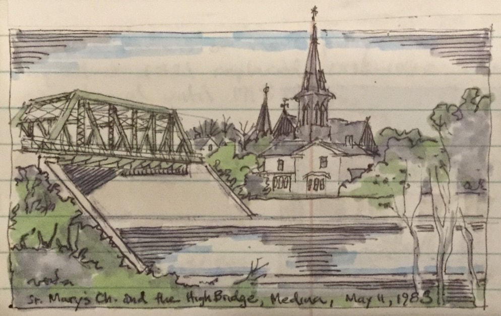 View of St. Mary's Church and the High Bridge from the canal, Medina. We didn’t linger. Canal bridges open for boats at 7:00 AM. After mugs of strong coffee and slices of coffee cake, we called ahead to the Prospect Avenue lift bridge, and pushed off. The operator was ready about ten minutes later and when our light turned green, only a few cars were delayed. It was a cloudy but mild morning and the canal waters were mirror-like. As we returned to a rural stretch of the canal we saw birds and a fox trotting along the towpath. Lora and Shauna made some breakfast burritos which we enjoyed on deck. 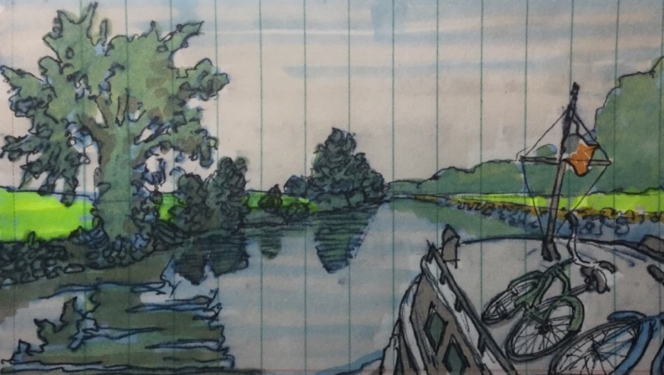 A rural stretch of the canal, west of Medina. Bow of "Belle Mule" in the foreground. Brent took the helm as we approached Middleport. We decided to stop here, see the town and replenish our ice chest. The bridge here was ready for us after a short wait, and Brent proceeded to dock us on the concrete wall next to the bridge. We hit the wall at an oblique angle with a full head of steam, knocking condiments off the galley shelves and ringing the ship’s bell! I jumped off the boat with a line before “Captain Crunch” could try it again and managed to pull the stern of the boat back to the wall and tie everything up parallel to the wall. Shauna had called ahead to find out where the nearest convenience store with ice was located. The gas station attendant told us it was only a few blocks from the canal. Maybe it seemed that way if you were used to driving around here, but the gas station turned out to be almost a mile away. Nevertheless, the exercise was good for us and we found some interesting architecture along the way including a cobblestone church.  Main Street lift bridge in Gasport, 1913. A breeze picked up later in the morning as we continued west. Brent brewed some fresh coffee just before we arrived at the Gasport lift bridge. The cabin top was cambered so I set my mug down on the deck as we throttled back to approach the bridge gently. Brent did the same. We were unable to raise the operator at first and a breeze was blowing us into the bridge. I tried backing us up while steering with the bow thruster but the wind kept trying to push the boat sideways. While stepping back and forth to see how much leeway I had on each side, I kicked both mugs over, making the steel deck both slippery and hot! After a few minutes of awkwardly trying to keep our boat in position, I gave up and headed the boat into an old wall. Brent tied us up and ran ahead to the lift bridge to ask some local fishermen there how we could get a hold of the operator. Just then, the bridge operator arrived by car and after picking Brent up, we went through the bridge. We arrived in Lockport sooner than expected. Lockport is a small city situated right on the edge of the Niagara Escarpment, the same landform that underlies Niagara Falls. This geological barrier thrown across the route to Buffalo and Lake Erie represented a critical engineering challenge for the original canal builders. It was met by devising a flight of stair-step locks up the slope, cut right into bedrock. The “Flight of Five” as it is now known, was one of the great engineering achievements of the original Erie. The original locks were enlarged in 1842 and one side of these (the five ascending locks) remain. The other side was replaced by two massive concrete locks completed in 1914 during the construction of the twentieth century Barge Canal. They have a combined lift of 49 feet. 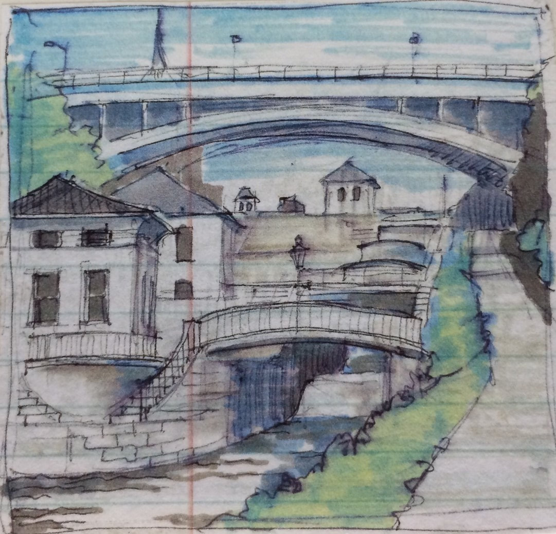 Lockport’s “Flight of Five” locks from 1842. The 1914 locks E-34 and E-35 are left of this view. The approach to Locks E-34 and 35 passes through a valley of sorts with increasingly high terrain on each side. We saw a series of big nineteenth century houses with generous lawns along Market Street to the south. The Adams Street lift bridge has been closed to traffic for some time and locked in the raised position for boats. The Exchange Street lift bridge remains operational and when we spoke with the operator, he alerted the locks a short distance further west. The canal takes a slight jog to the left and the gates of the big locks loom ahead with turbulent water in the pool below. Dave, one of two extremely friendly operators here asked us to wait as he locked down an eastbound tour boat. He then gave us the green light, guided us into the first lock chamber and took us up. The gates at the west end of the chamber opened and admitted us to the second chamber. Again, the gates closed behind us and we rose to the top of the escarpment. Once in position, he walked over to introduce himself and invited us to tie up on a wall that leads to the historic locks where excess water is discharged. It was a very kind offer that put us right in the center of Lockport’s most interesting attractions and spared us from having to resort to the upper terminal wall at least half a mile further west. 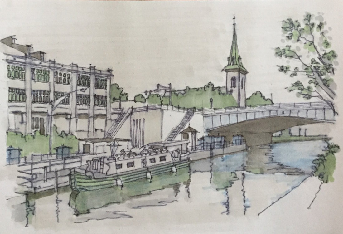 "Belle" tied up above Lock E-35 in Lockport. After securing the Belle we walked a short distance into town to visit the Erie Canal Discovery Center, situated in a nineteenth century stone church building. The Center offers a 15-minute documentary describing the construction of the first locks as well as interesting artifacts. We explored the “Flight of Five” locks which were recently restored to operation for small boats. The current locks were completed in 1842 and were in use for more than 70 years. The limestone walls and wrought iron railings have grooves worn in them from the repetitive use of taut tow lines hauled by straining teams of horses and mules. We picked up lunch at a nearby burger joint and ate at a terrace overlooking the locks. We went to the famous Lake Effect ice cream shop for sundaes and enjoyed them under a gazebo on Canal Street. We were less than a day from Buffalo and the western terminus of the canal, but we did not have enough time remaining with the “Belle” to cruise there, find an overnight berth in one of the Tonawandas and still make it east to Seneca Falls. We needed to turn back now. We said goodbye to Dave, the lock operator and he prepared lock E-35 for our entry without any wait. I made a complete hash out of getting into the lock with the creeping transmission, banging the wall and lining up crooked. Up in the bow, Brent had almost no line to grab. In the stern, my boat hook inadvertently extended and I nearly lost my purchase on the line at my end. Fortunately, we went down quickly, entered E-34 and went down there just as quickly. The huge gates boomed open. A tour boat was waiting just outside to lock up. We waved to the passengers, thanked Dave on the radio, and slowly got underway. “Captain Crunch” took the helm and we began the three-day return to Seneca Falls.  AfterwordTransiting the historic Barge Canal system and discovering the communities that grew up along its path is a perfect way to reconnect with people, experience our state in a more intimate way and to better appreciate the history and natural beauty of New York State. The slow pace of travel along the canal encourages exploration, reflection, creative pursuits and the opportunity to get to know people and towns that are invisible while driving at high speeds to more traveled destinations and cities. The unplanned discoveries, minor incidents and occasional challenges enrich the experience and deepen its authenticity. The Erie Canal and its branches once defined New York State and the ability of New Yorkers to accomplish what others could not imagine. The system still connects all of state’s major cities by water. It still links the Hudson River, the Great Lakes, the Finger Lakes, Lake Champlain and many of New York’s most popular recreational destinations. The canal system contributes to irrigation, flood control, and power generation. Importantly, it remains available albeit underutilized for commercial transportation, especially for oversized products such as turbines. Today’s canal system is a significant driver of heritage tourism providing a scenic corridor for private, rental and tour boats as well as for walkers, paddle driven craft and bicyclists. It is strikingly beautiful. Landscapes both grand and prosaic come into focus at each turn and canal-side communities with historic main streets have rolled out the red carpet for visitors. In spite of this, New York State’s canals are still enjoyed by and appreciated by too few. In recent years, the maintenance and operation of these canals, once managed by the NYS Department of Public Works and NYS Department of Transportation, has been transferred to the NYS Thruway Authority and now the NYS Power Authority, an organization headquartered in White Plains with little institutional affinity for navigation. The current Reimagine Initiative, begun in 2017, offers an opening to canal critics who feel the system costs to much, benefits too few, and should be dismantled into small recreational segments for local uses. Instead of diminishing our canals, the system should be protected as the critical waterway that connects virtually all of New York State. I hope readers of this account will discover the Barge Canal while it remains fully operational. Explore its navigable waters, spend money in its towns, commune with New York State’s past and advocate for its continued operation as a navigable waterway and corridor for investment. 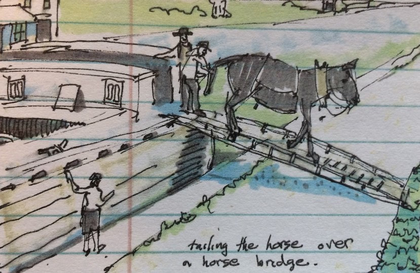 End of the day on the canal in the nineteenth century. AuthorMuddy Paddle grew up near the junction of the Hudson River and the Erie Canal. His deep interest in the canal goes back to childhood when a very elderly babysitter regaled him with stories about her childhood on the canal in the 1890s. Muddy spent his college years on the canal and spent many of his working years in a factory building overlooking the canal. Over the years he has traveled much of the canal system by boat and by bicycle. That's all folks! Thank you for joining us on this Erie Canal journey. To read other adventures by Muddy Paddle, see: Muddy Paddle: Able Seaman, about Muddy Paddle's adventures on the replica Half Moon, and Muddy Paddle's Excellent Adventure on the Hudson, about his canoe trip down the Hudson River.
The History Blog is supported by museum members and readers like you! Donate or join today! Editor’s Note: Welcome to the next episode in our 11-part account of Muddy Paddle's narrowboat trip through the Erie Canal and the Cayuga & Seneca Canal in western New York. The New York State Barge Canal system is in many ways a tributary of the Hudson River. It still connects the Great Lakes, the Finger Lakes, and Lake Champlain with the Atlantic Ocean by way of the Hudson River. Our contributing writer, Muddy Paddle, shares his experiences aboard the "Belle Mule." All the included illustrations are from his trip journal and sketchbooks. Day 10 - MondayI quietly brewed a cup of coffee and climbed out of the Belle for a short walk and a sketch. It is warm and humid and the sky was already threatening. When I got back to the boat, Brent was up and out and talking with a young village police officer. We treated ourselves to breakfast at a nearby diner and called ahead for the bridge operator before disconnecting shore power and casting off our lines. When we were lined up, the Main St bridge went up and we throttled up on our way to Albion and Medina. 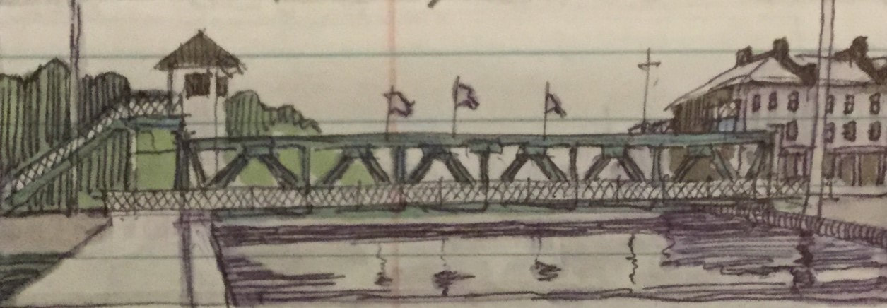 Main Street Lift Bridge in Albion, 1914. We called the bridge operator at Holley and the bridges that he operates at here and at Hulberton were ready as we approached each. About six miles later, we arrived at Albion. Just as in Brockport, docking is situated between two lift bridges so we explained to the operator that we only needed a lift at Ingersoll Street. We tied up along the bulkhead with rotten timbers and were immediately beset by bees. It was hot and humid and it looked as though we were close to getting slammed by another strong thunderstorm, so we closed all of our window ports and hatches and locked everything up before exploring the town.
Albion is the county seat of Orleans County. The business district is centered along a north-south Main St extending perpendicularly south from the canal. A block of very early canal stores with hipped roofs and stepped parapets remains at the lift bridge. There are also handsome late nineteenth century commercial buildings with cast iron storefronts and bracketed cornices for several blocks south. The courthouse square begins two blocks south of the canal. A domed courthouse is at the center and impressive churches gather around the surrounding streets. We visited an antique store and picked up a couple of small and inexpensive souvenirs. We walked up to the Post Office to see a terrific WPA mural of a generic canal town at a prosperous moment. A tug and barge are passing beneath the open lift bridge, farms are cultivating in the distance and a factory employing townsfolk belches coal smoke nearby. 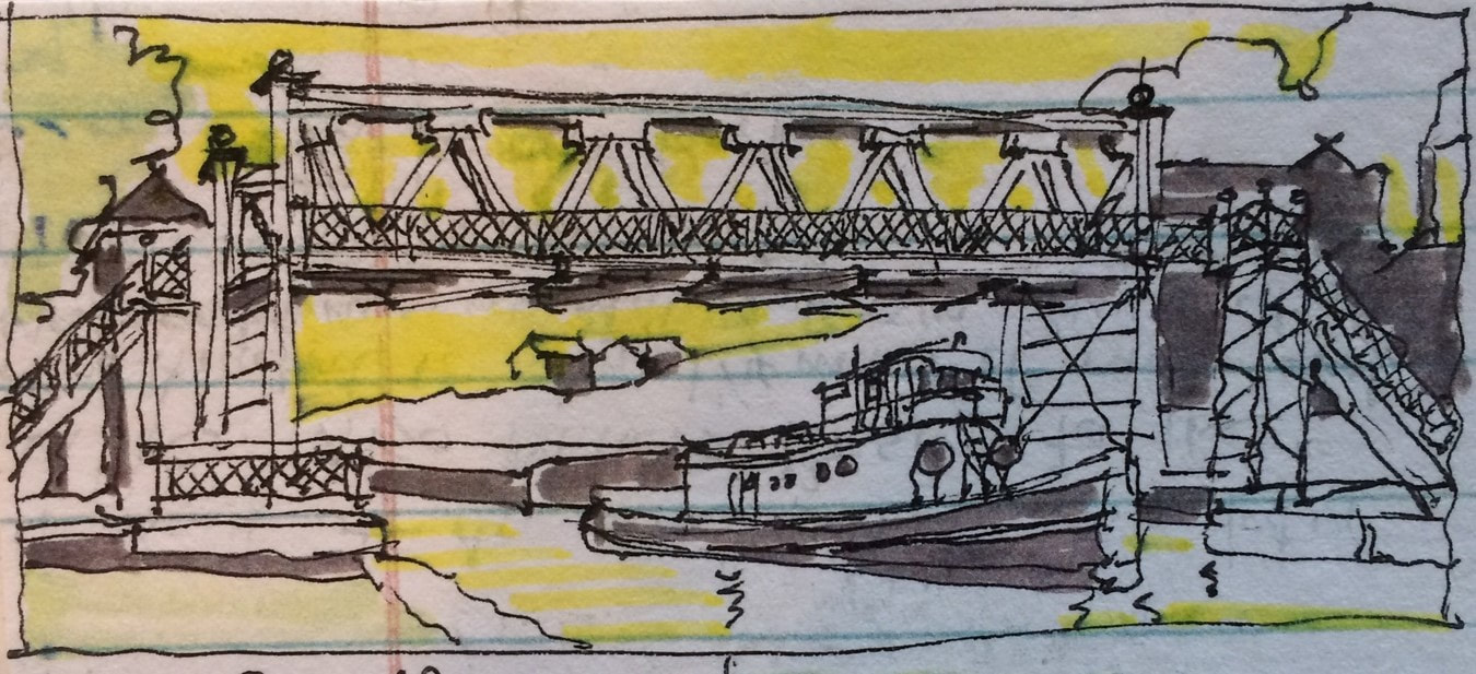 WPA mural in the Albion Post Office. The southern horizon was filled with an ominous purple cloud bank with white wispy clouds gathering around its base. A huge storm was rampaging only a few miles away from us but it seemed to be moving east and not likely to spread in our direction. We walked over to the George Pullman Memorial Unitarian Church in hopes of experiencing its lavish Tiffany interior. Built in 1894 by Pullman as a gift to his original hometown, the church is a beautiful but scaled-down cousin of the famous Trinity Church at Copley Square in Boston. Pullman made his fortune building richly appointed Pullman cars for the railroads. Albionites have said that he got the idea from the long packet boats with sleeping bunks passing through town on a regular basis. Unfortunately, the church was closed. Grateful for having dodged the big storm, we returned to our floating version of a Pullman car, waded through the bees and called the Main Street bridge for a lift. The operator was ready for us as soon as we were in place and traffic on Route 98 came to a stop for a few moments as we left Albion behind. We travelled through orchards and fields cultivated for corn and cabbage with only a fringe of trees and bushes along the banks of the canal. An eagle jumped off of a tree limb hanging over the towpath and swooped down over the canal ahead of us before ascending high above the farmland to our south. It was still hot and humid and the skies to our south remained dark purple and stormy. We called ahead to the Eagle Harbor lift bridge and the operator was ready for here and also at Knowlesville a few miles further west. Eagle Harbor still has a brick church along the canal from its heyday as a small canal port, but little else remains. 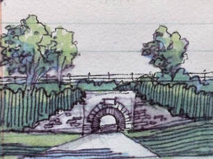 The Medina Culvert passing under the canal. The Medina Culvert passing under the canal. About one mile further west, we passed over the Medina Culvert, a stone arched tunnel beneath the canal that carries Culvert Rd beneath the raised embankments of the canal. The culvert was begun in 1823 and lengthened as the canal was widened in the 1840s and again in 1916. We stopped the Belle here and stood up on the cabin top where we could see the road below us north and south. Unfortunately, there was no place to safely tie our boat up so that we could climb down and visit the site. The humidity finally broke as the big wide loop in the canal east of Medina came into view with rooftops and steeples in the background. One portion of this loop serves as an aqueduct, carrying the canal above Oak Orchard Creek. The other portion serves as a wide boat basin with a long dock running behind Medina’s business district. Brent drove us toward the long dock but came in a little too fast. We hit the bulkhead hard. The steel hull “took another one for the team” but gave up little more than paint. “Captain Crunch” roughed up a little more steel trying to square the boat up, much to the amusement of three obnoxious teens mocking us out from a nearby picnic table. The same teens who chuckled at our rough landing misdirected us when we asked about where we could find ice. After fooling around along Main Street for half an hour, Brent and I stopped in a Mediterranean style family restaurant and asked the hostess if she could tell us where we could buy ice. She said, “just a moment,” and returned a few minutes later with two ten-pound bags of ice, compliments of the house. Meanwhile, a troupe of fitness fillies arrived at the landing and began a rhythmic exercise routine with loud music and drumsticks. They beat the pavement and steel railings hard while an elderly gent nearby took an unhealthy interest. Brent and I returned to the boat to make dinner only to find that the meat was ironically frozen solid. Given the racket next to the boat, everyone was ready to get dinner on Main Street. We opted for the same friendly restaurant with the free ice. 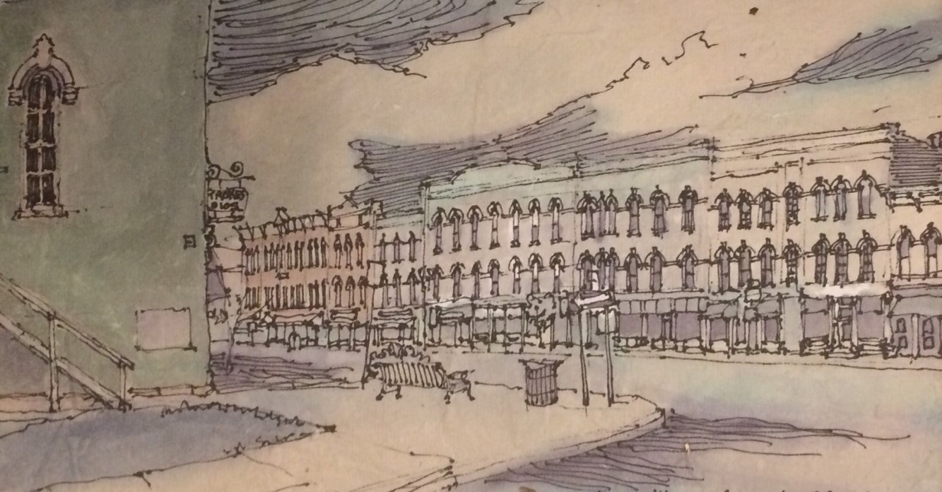 Main Street, Medina. Medina’s Main Street features rows of remarkably well-preserved nineteenth century business blocks, many built from locally quarried Medina sandstone. These buildings include handsome cast iron storefronts, hooded windows and elaborate cornices and parapets. A tall sandstone opera house built in 1865 was being restored. The sandstone town hall included an exhibit on Medina’s famous quarries and stone cutters. Like many canal towns, Medina still has echoes of its Irish canawler heritage. Fitzgibbons Public House on Main Street is one of these icons. Medina has something many other towns are missing; music piped-in from the business district street lamps. After dinner, we walked over to the Railroad Museum, well after it had closed. We were sorry to miss the 200 foot-long train layout in the New York Central freight house, but enjoyed seeing historic rolling stock on one of the sidings including two big GM diesel locomotives from the early 1950s painted in Twentieth Century Limited livery. We returned to our boat, played Pictionary at the galley table and took serious showers at the transient boater facility a short walk away. Some sprinkles came along at night but none of the anticipated thunderstorms developed. AuthorMuddy Paddle grew up near the junction of the Hudson River and the Erie Canal. His deep interest in the canal goes back to childhood when a very elderly babysitter regaled him with stories about her childhood on the canal in the 1890s. Muddy spent his college years on the canal and spent many of his working years in a factory building overlooking the canal. Over the years he has traveled much of the canal system by boat and by bicycle. Muddy Paddle's Erie Canal adventure will return next Friday! To read other adventures by Muddy Paddle, see: Muddy Paddle: Able Seaman, about Muddy Paddle's adventures on the replica Half Moon, and Muddy Paddle's Excellent Adventure on the Hudson, about his canoe trip down the Hudson River.
The History Blog is supported by museum members and readers like you! Donate or join today! Editor’s Note: Welcome to the next episode in our 11-part account of Muddy Paddle's narrowboat trip through the Erie Canal and the Cayuga & Seneca Canal in western New York. The New York State Barge Canal system is in many ways a tributary of the Hudson River. It still connects the Great Lakes, the Finger Lakes, and Lake Champlain with the Atlantic Ocean by way of the Hudson River. Our contributing writer, Muddy Paddle, shares his experiences aboard the "Belle Mule." All the included illustrations are from his trip journal and sketchbooks. Day 9 - Sunday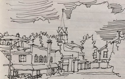 Vignette of Spencerport. The rain let up in the morning and I went out to do a little thumbnail sketch of the village (above). One of the locals was interested in what I was doing and came over to chat. He worked as a garbage man and told me that “he sees everything.” He noted that the white steeple in my sketch became the subject of a favorite photograph he produced when he saw it gleaming against a dark storm cloud. A hole in the cloud admitted a single shaft of blinding white light trained right on the church. He printed this image many times with different hues and colors and still considered it one of his best pieces. 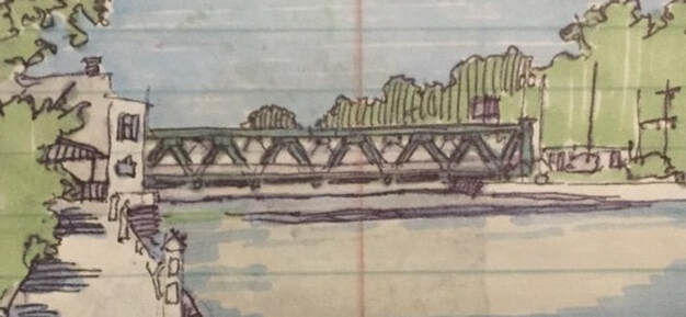 1915 Union St Lift Bridge in Spencerport. 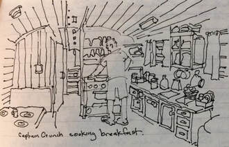 Galley aboard the "Belle" with Brent at the range. Galley aboard the "Belle" with Brent at the range. Brent manned the range and made frittatas for breakfast. After several reinforcing cups of hot coffee, we disconnected our shore power, cast off lines and headed west under the Union Street lift bridge. This is the first in a series of 15 similar lift bridges we will pass beneath, all built between 1910 and 1918. These bridges were a practical necessity for many canal town business districts where obtaining sufficient vertical clearance for tugboats and motor ships with conventional fixed spans would have required long approaches blocking access to essential stores and businesses situated in close proximity to the canal. The bridges are built with riveted Warren trusses and rise and fall on four legs placed in caissons. The caisson on one side features an electric motor and a counterweight approximating the dead weight of the bridge. Cables linking the legs together beneath the bridge deck transmit the lift equally to all four legs. The bridges typically feature an operator’s tower with good visual range up and down the canal, stairs that allow pedestrians to cross when the deck is raised, crossing gates and signal lights to stop traffic and a clanging bell to alert everyone that the bridge is in motion. They are a defining feature of the western portion of the canal for both the boaters and the towns. 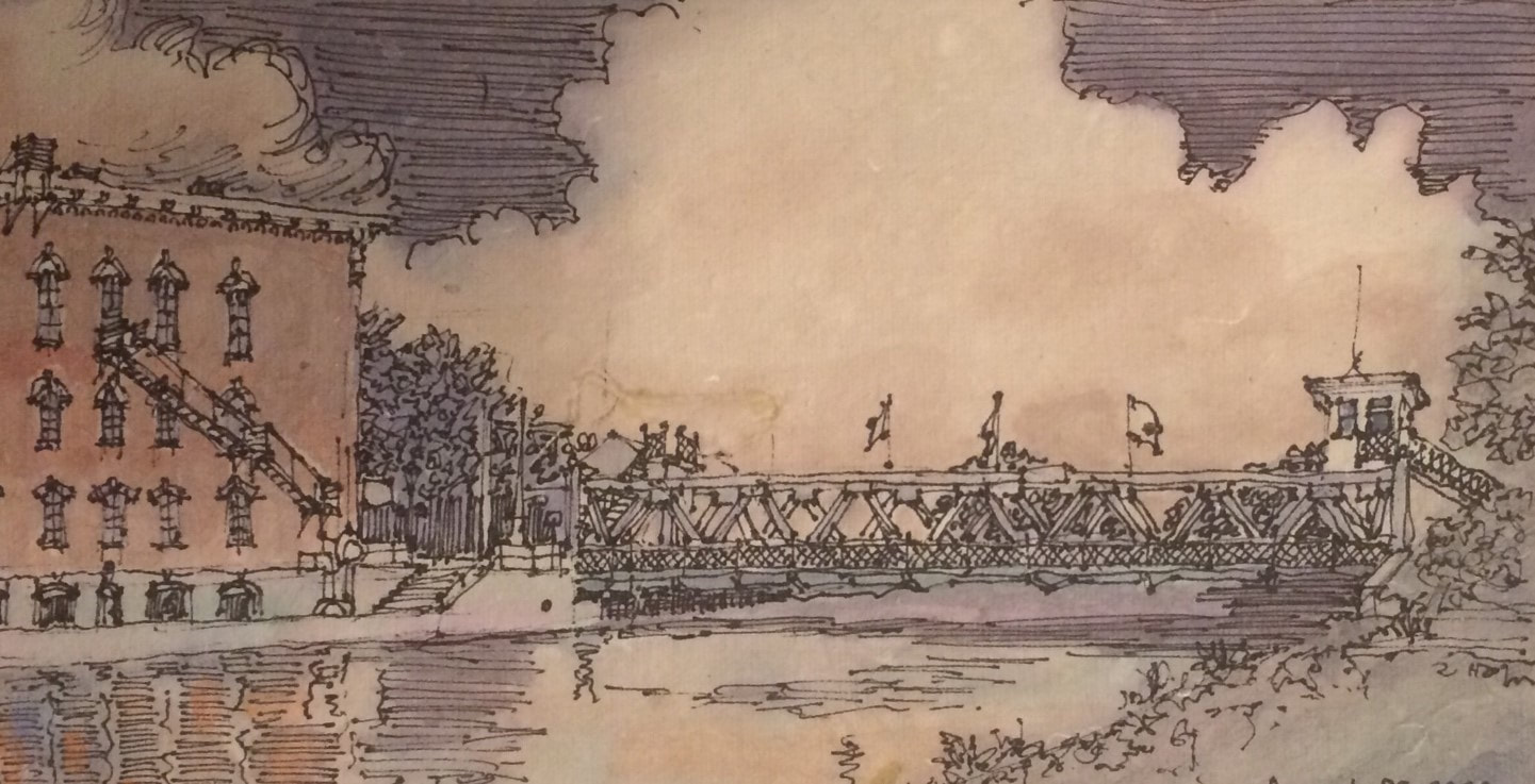 1915 Main Street lift bridge at Brockport. We reached a second lift bridge about 30 minutes later in Adams Basin. Adams Basin, once a port for warehousing and shipping agricultural products is now quiet with only a few houses and barns. A mid-nineteenth century canal inn survives on the north bank of the canal and was fittingly used until recently as a bed and breakfast. The bridge operator spoke with us on channel 13 and was ready for us when we arrived. There was no traffic to disrupt here. As we continued west, he pleasantly transmitted “Have a nice day, captain.” Today’s destination is Brockport. Docking is situated between two lift bridges and unlike Adams Basin, both carry plenty of traffic. The bridge operator shuttles between the two bridges by bicycle. We called ahead to let her know that we needed to pass under the Park Avenue bridge but not the Main Street bridge. Appreciating the heads-up, the bridge was already up as we approached with plenty of cars backed up. Other boats were on the wall at Harvester Park and we had a tricky piece of parallel parking to perform to claim our space. Brockport was founded in 1823 when it briefly served as the western terminus of the Erie Canal. Heil Brockway built packet boats here and operated a successful line between Rochester and Buffalo soon after the canal was completed. A college was established here in 1841 which evolved into today’s State University College at Brockport, the institution that now dominates the village economy and culture. And in 1846, Cyrus McCormick, founder of International Harvester, produced the first successful mechanical harvesters in the world at a Brockport foundry, hence the appellation “Harvester Park.” 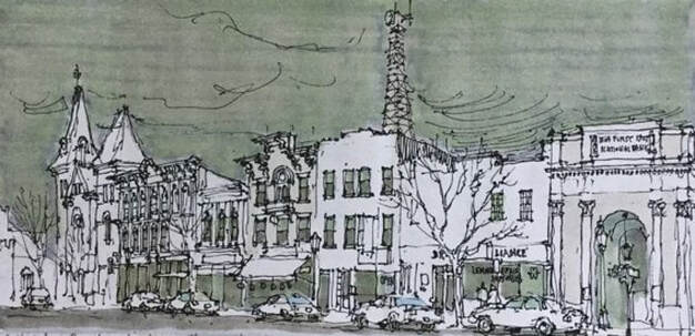 Main Street, Brockport. In many ways, Brockport is the quintessential canal town. Its Main Street is perpendicular to the canal and lined by two and three story brick commercial blocks with cast iron storefronts and bracketed cornices. Steepled churches rise up around the fringe of the business district. Brick and frame houses fill out the blocks more distant from the canal and the college campus stretches west from the residential neighborhoods to farm fields outside of the old village. A modern area of banks, supermarkets and fast food is located about a mile south of the canal. The banks of the canal were lined with livery stables and storage buildings, several of which remain and are now used for businesses and restaurants. The village is keenly aware of its history and has pioneered a “museum without walls.” Street signs are custom made with silhouettes of canal boats, trains and trolleys. The presence of the college has supported restaurants, local brewing, coffee shops, a really nice bookstore and even a symphony orchestra! We removed our bikes and set off to visit the 1894 Soldiers Memorial about a mile east of the village. After the Civil War, a local initiative got underway to establish a veterans’ cemetery in town. Following the philosophy that “if you build it, they will come,” a chapel, vault and observation tower were built to promote the project. Only several veterans were buried before the project petered out. The Gothic-styled tower with a spiral staircase to an observation gallery was neglected but survived for decades and became a destination for many college students. By the 1970s, the spiral stairs were mainly broken and the gallery had begun to collapse. In recent years, the tower was stabilized without the gallery and rededicated. We had a little difficulty finding the site off Owens Road but got help from neighbors who directed us to a hill behind a fire station. The truncated tower is now well cared for and well worth looking for.
We remounted our bikes and rode into the village and then over to the college campus for a little tour. The town and campus are compact and pedestrian friendly. We checked out menus at several restaurants and decided to return in the evening to a place in an old canal building next to the Main Street lift bridge. After putting our bikes back on the boat, we decided to make a short three-mile boat trip to Holley to visit the canal park and waterfall. Holley is a small town built around a large square surrounded by two and three-story commercial buildings with cast iron storefronts. A Romanesque style campanile of a former church presides at the head of the table so-to-speak. The canal by-passed the square in 1856 and today, only the East Avenue lift bridge suggests the presence of a town while transiting the canal. We docked at the canal park, and planned to picnic at the gazebo, but a young Marine in his dress blues and his bride were there for photographs as we carried lunch off the boat. 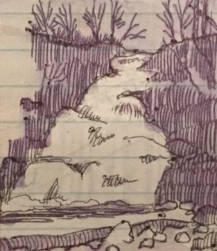 Waterfall at Holley. Waterfall at Holley. We found a picnic pavilion nearby and decamped there. After lunch, a couple of kids showed us the way to the waterfall. The waterfall is associated with a waste weir or spillway on the canal. After cascading down a steep, rocky bank, excess canal water flows into a creek which then flows north into a culvert and under the canal. We returned to Brockport, walked around Main Street and Market Street and had a pleasant dinner alongside the canal. After dinner, we went out for ice. In the evening we played a trivia game. We had a restless night on the wall. It began with a couple of loud drunkards on the opposite bank of the canal sitting on a park bench and repeatedly asking “eh?” followed by colorful but innumerable f-bombs. Voices really carry over the water. Later, a deranged duck relentlessly pecked the Belle’s steel hull waterline in search of mussels. I woke up early, wrote in my journal and went back to bed for a few more hours. AuthorMuddy Paddle grew up near the junction of the Hudson River and the Erie Canal. His deep interest in the canal goes back to childhood when a very elderly babysitter regaled him with stories about her childhood on the canal in the 1890s. Muddy spent his college years on the canal and spent many of his working years in a factory building overlooking the canal. Over the years he has traveled much of the canal system by boat and by bicycle. Muddy Paddle's Erie Canal adventure will return next Friday! To read other adventures by Muddy Paddle, see: Muddy Paddle: Able Seaman, about Muddy Paddle's adventures on the replica Half Moon, and Muddy Paddle's Excellent Adventure on the Hudson, about his canoe trip down the Hudson River.
The History Blog is supported by museum members and readers like you! Donate or join today! Editor’s Note: Welcome to the next episode in our 11-part account of Muddy Paddle's narrowboat trip through the Erie Canal and the Cayuga & Seneca Canal in western New York. The New York State Barge Canal system is in many ways a tributary of the Hudson River. It still connects the Great Lakes, the Finger Lakes, and Lake Champlain with the Atlantic Ocean by way of the Hudson River. Our contributing writer, Muddy Paddle, shares his experiences aboard the "Belle Mule." All the included illustrations are from his trip journal and sketchbooks. Day 8 - Saturday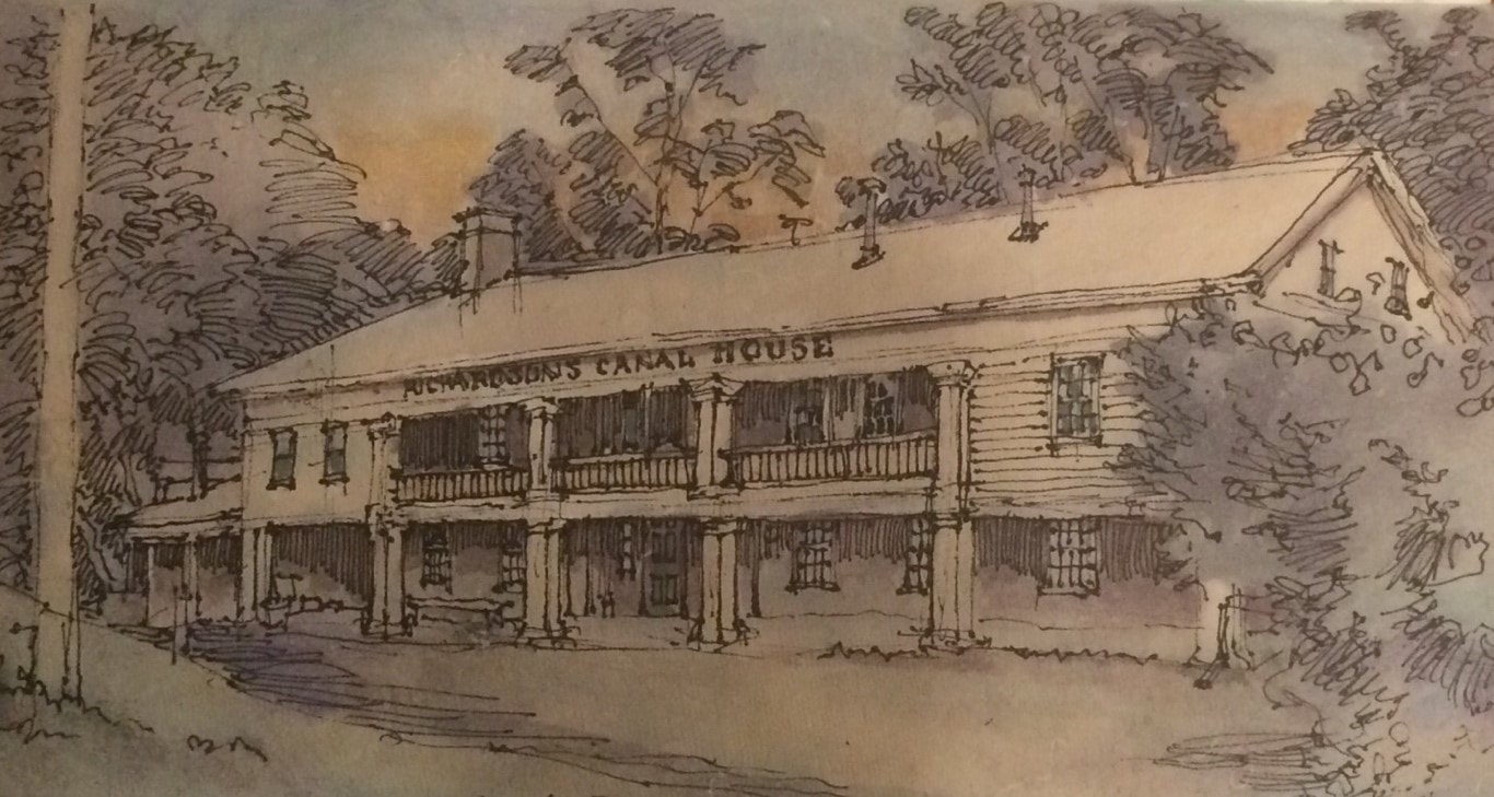 The old Bushnell’s Basin canal inn established in 1818. Bushnell’s Basin is a small hamlet just west of I-490 and east of the Irondequoit Creek. It was settled before the canal arrived and manufactured gunpowder and milled lumber. An inn was established in 1818 and after a long decline briefly became a nudist retreat. The inn was rescued from oblivion in the 1970s. Richardson’s CanalHouse became a high-end restaurant for Rochester area diners. Located a few feet below the canal berm, it is also an exceptional example of early-nineteenth century architecture. I was up before dawn in hopes of sketching the inn. It was chilly and damp. Sketching in the dark is literally sketchy, but under a street lamp, I was able to rough the outline of the building and its wooded setting. As the sky lightened, I was able to add some detail and color. Brent caught up with me, and we walked into the hamlet to get strong coffee and a bag of really good bagels. After breakfast, we said goodbye to our neighboring boaters, used the bow thruster to extricate the Belle from the adjacent boats and headed west over a very historic stretch of the canal known as the Great Embankment, an earthen berm elevating the canal above the Irondequoit Creek and valley. The first iteration of this high embankment was built between 1818 and 1822 and was heroically built with wheelbarrows and shovels, raising the canal high above the surrounding countryside. It has been widened and reinforced a number of times, notably after devastating failures in 1912 and 1974 which flooded the lands below. Vegetation has grown up along the sides of the embankment, but between gaps in the trees, one can still see fields well below the grade of the canal. We entered Pittsford about ten minutes later. Pittsford is a pretty village with fine early nineteenth century architecture including the old Phoenix Hotel completed around 1820. Over the years, this hotel hosted DeWitt Clinton, Lafayette, Daniel Webster and Cornelius Vanderbilt among others. In the twentieth century Pittsford became a suburb of the growing city of Rochester. The historic buildings of the village are treasured and protected. The docks here were full of boaters, making even a short visit impossible. 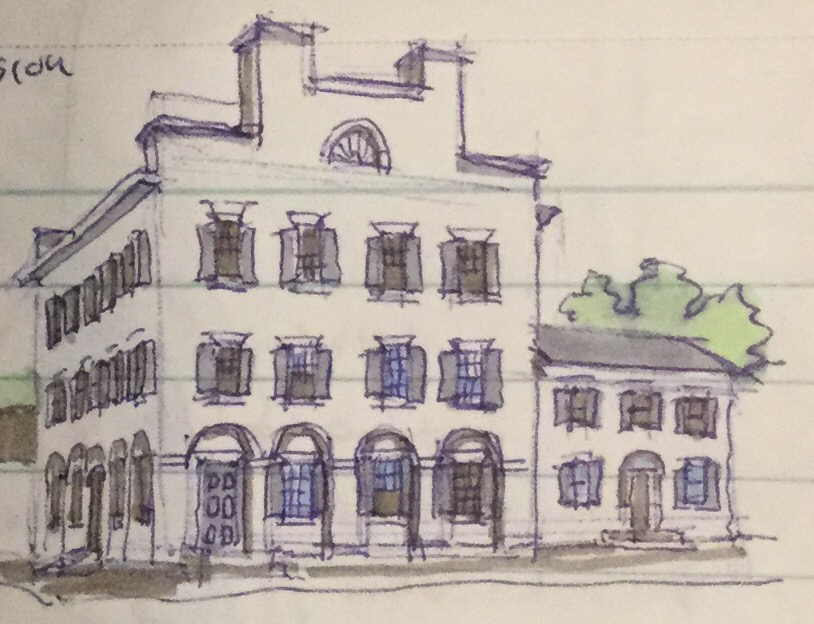 The former Phoenix Hotel in Pittsford. On the west side of Pittsford, we could see the stub of a short channel where the Erie Canal bent north along its original path into downtown Rochester. The Barge Canal, built between 1905 and 1918 bypassed downtown Rochester. Demolition necessary for widening would have been too costly and disruptive. The canal was already snarling traffic as downtown lift bridges were constantly being raised and lowered, closing critical city streets each time. We locked up through E-32 and E-33 which are situated in close proximity to each other just south of Brighton. We passed through about four miles of urban sprawl, malls, ugly highway bridges, and incessant traffic noise before reaching the relative quiet of Genesee Valley Park and our intersection with the Genesee River. The Genesee River flows north from the cavernous valley now occupied by Letchworth State Park to the High Falls in downtown Rochester before emptying into Lake Ontario. The falls were a major source of water power and sprouted mills in the early years of the nineteenth century. Once the Erie Canal arrived and provided the means to ship grain in bulk inexpensively to Albany and New York, Rochester exploded in population and industry, growing from a population of 2,500 in 1821 to 13,500 in 1834. The river south of the city is languid and curving with park-like banks. 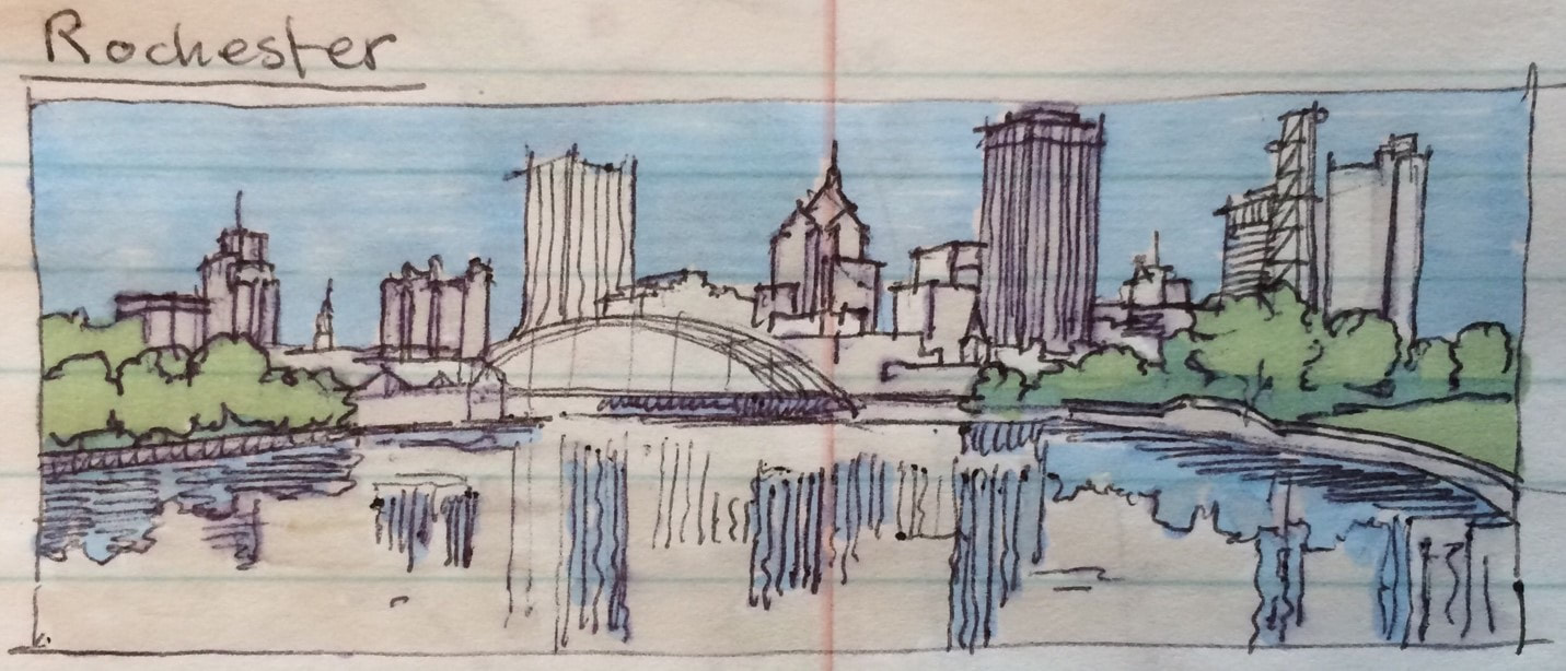 The Genesee River approaching downtown Rochester with the arched Frederick Douglass and Susan B. Anthony Bridge. We encountered kayakers at the Genesee Waterway Center listening to music with earphones and unaware of our approach, so the Belle slowed to a crawl to avoid each of them. We passed the University of Rochester’s riverside chapel and passed beneath several city bridges before reaching the Corn Hill Landing. Just ahead was the Court Street dam and the end of navigation. Beyond the dam, the river is shallow, rocky and swift as it passes through downtown and over the precipice at High Falls. We found plenty of room at the landing, tied up, locked up our boat and set off on foot to explore a little of Rochester. Our first destination was the 1842 Erie Canal aqueduct over the Genesee River, the second one built at the site. After the Barge Canal bypassed downtown, the stone-arched structure was modified in 1924 to carry subway trains through the trough of the closed canal while a second series of arches carried vehicular traffic above on what became Broad Street. The subway is gone and some canal aficionados still dream of watering the aqueduct for small boats. Other stone arch bridges remain over the river. The Main Street Bridge north of the canal was once lined by stores along the lines of the Pons de Vecchio in Florence so that walking down Main Street, there was no awareness of crossing over the powerful river. The stores were removed during urban renewal destroying this interesting anachronism but restoring a visual connection to the river. 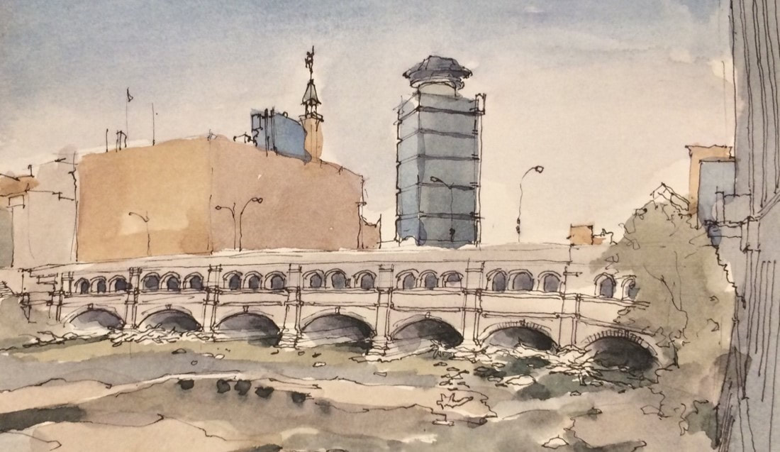 1842 Erie Canal aqueduct now supporting Broad St. in downtown Rochester. 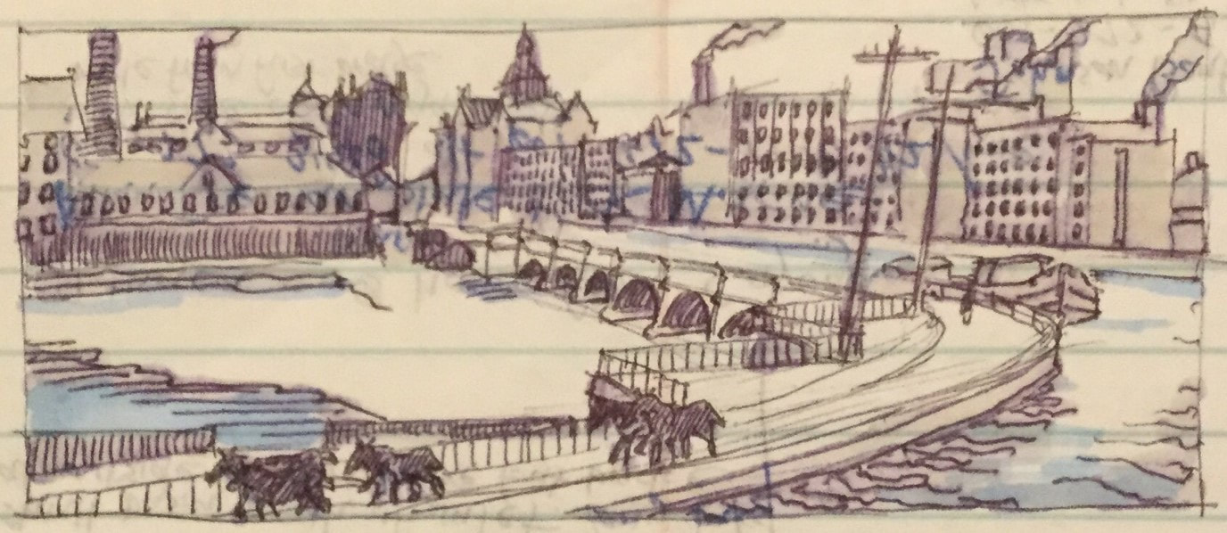 The 1842 Genesee River aqueduct in use before downtown Rochester was by-opassed by the NYS Barge Canal. We walked up State Street and the wedding cake-like Powers building toward the High Falls district north of downtown. We explored Brown’s Race and the stone ruins of the Triphammer forge before walking over the high Platt Street Bridge where we got a good look at the High Falls on the Genesee. Here, just beyond utilitarian rail and highway bridges, the river falls 100 feet straight over a cliff into a limestone chasm, pock marked by hydraulic tunnels once associated with the thriving milling industry. It was here on Friday the 13th of November 1829 that Sam Patch, popularly known as the “Jersey Jumper” attempted to jump the falls before 8000 spectators, weeks after successfully conquering Niagara Falls. He failed to surface and his frozen body was discovered months later near the river’s mouth.
We attempted to get lunch at the Genesee Brewery on Cataract Street, but the line was long and we were anxious to return to our boat and find a quiet place to tie up for the night before it got dark. We met a couple from Texas with a smaller version of our boat tied up right behind us. They recently purchased it from the rental company in Macedon and they invited us to take a tour. We were impressed! We got underway and headed up the river to the junction with the canal. Lora and Shauna made sandwiches and upon reaching the four corners of the river and canal, we turned west with hopes of reaching Spencerport for the evening. During the first hour, we passed through a channel cut straight through layers of limestone. This channel was bridged by about a dozen structures including highway bridges and a series of massive steel railroad bridges, most of which were abandoned. In Gates, at the western end of the rock cut, we re-entered the path of the original Erie Canal at Junction Lock. Here, the other stub of the original canal coming out of downtown Rochester remains. Quite a few folks in this area use the towpath for dog walking, jogging and photography. Brent drove the boat the remainder of the way to Spencerport. The canal here passed through open fields and woods. One farm appeared to have found a new life as a wedding venue. After passing an abandoned dormitory barge, two fisherman darted out of a hidden boat basin into our path without looking and Brent had to throw the Belle into reverse in order to avoid running them over. We arrived in Spencerport just before dark. Our boater friends from Bushnell’s Basin were here with a campfire and warily watched us dock our big, clumsy steel boat next to their fiberglass cruiser. They took our lines and exclaimed wryly that we were like “dog s--t on the bottom of their shoes.” We responded by picking up a six-pack of locally-brewed “Too Kind” beer for them at the in-town grocery. It began to rain. We buttoned up the Belle, prepared leftovers for supper and played a trivia game. Brent is very competitive and we got loud enough to probably annoy our friends and a few other boaters. After a few off-color outbursts, we figured it would be best to call it a day. It rained hard but we had a dry and restful night. AuthorMuddy Paddle grew up near the junction of the Hudson River and the Erie Canal. His deep interest in the canal goes back to childhood when a very elderly babysitter regaled him with stories about her childhood on the canal in the 1890s. Muddy spent his college years on the canal and spent many of his working years in a factory building overlooking the canal. Over the years he has traveled much of the canal system by boat and by bicycle. Muddy Paddle's Erie Canal adventure will return next Friday! To read other adventures by Muddy Paddle, see: Muddy Paddle: Able Seaman, about Muddy Paddle's adventures on the replica Half Moon, and Muddy Paddle's Excellent Adventure on the Hudson, about his canoe trip down the Hudson River.
The History Blog is supported by museum members and readers like you! Donate or join today! Editor’s Note: Welcome to the next episode in our 11-part account of Muddy Paddle's narrowboat trip through the Erie Canal and the Cayuga & Seneca Canal in western New York. The New York State Barge Canal system is in many ways a tributary of the Hudson River. It still connects the Great Lakes, the Finger Lakes, and Lake Champlain with the Atlantic Ocean by way of the Hudson River. Our contributing writer, Muddy Paddle, shares his experiences aboard the "Belle Mule." All the included illustrations are from his trip journal and sketchbooks. Day 7 - FridayIt was a sunny and cloudless morning and we spent a few relaxing hours getting organized and making breakfast. It is Lora and Brent’s anniversary so Brent went out to pick a pink wildflower for Lora for the breakfast table. We called the lock operator at E-29 and cast off lines around 9:00 AM, entering the lock almost immediately. After about a mile, we stopped at a dock to look at the ruins of old lock 60 built in 1841 and now maintained as a park. When we got underway again, Shauna and Lora set up folding lawn chairs in the bow and just enjoyed the sun and the unfolding landscapes and wildlife. By now they had learned that the ducks would always swim aside at the last minute as we approached. Yelling back to the guy at the helm was not necessary.
We continued west to Macedon and locked up at E-30. Macedon, named for Alexander the Great’s homeland, is a small canal town once prominent in the manufacturing of seed drills. Today, it is the home of Erie Canal Adventures, a canalboat rental company and marina. The facility is situated around a basin on the west end of town where several freshly painted red and green narrow boats are ready for the next renters. Previously owned by Peter Wiles who introduced these boats to the Barge Canal, the company still takes pride in maintaining their fleet and making trips enjoyable for their customers. An enormous thunderstorm blew up as we approached a wide section of the canal which came to be known as Wayneport. Towering clouds ominously darkened the sky as thunder boomed. Heavy rain and a brief pelting of hail reduced our visibility and we slowed to a crawl hoping to avoid the canal banks or any approaching boats. The storm passed over quickly and the temperature dropped about 20 degrees. We had planned to visit the Union Burying Ground here where canal laborers with smallpox were buried, but we had passed the bridge at Wayneport Road and decided not to turn back. Three miles later, we entered Fairport. 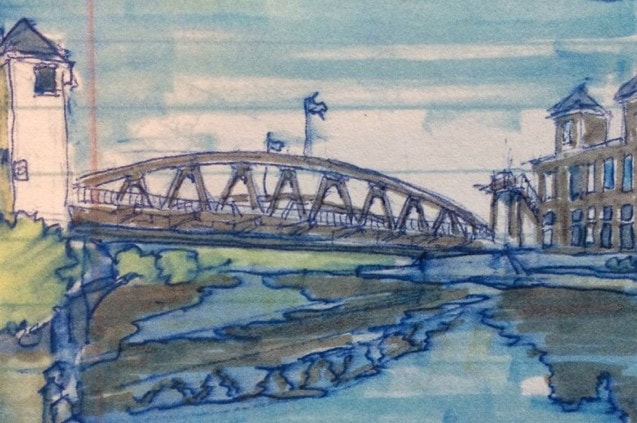 The 1914 Main Street Lift Bridge in Fairport. Fairport is a substantial canal town and boater mecca. Esplanades have been created between a high truss road bridge at the east edge of downtown and the 1914 Main Street Lift Bridge at the center. This area is lined with restaurants, shops and expensive fiberglass cruisers. The village developed in the mid-nineteenth century and industries included the packing and export of fruit and vinegar. The predecessor of the American Can Company got its start here and in spite of extensive urban renewal, a few factory buildings and brick chimneys remain. We spent the afternoon here getting lunch food, exploring the shops, and taking luxurious showers at the boater welcome center. Shauna and Lora made dinner reservations, Brent took a ten-mile bike ride along the towpath, and I met Paul, an 81-year old artist who was painting a local tour boat and its reflection on the canal. I walked up to Fairport Road, the main east-west highway here and sketched an interesting Victorian Gothic church with a very spiky steeple while sitting on a bus stop bench. An elderly woman joined me on the bench while waiting for the Rochester bus. Clearly annoyed that she had to share the bench with me she asked, “why don’t you just take a picture with your cell phone and go?” 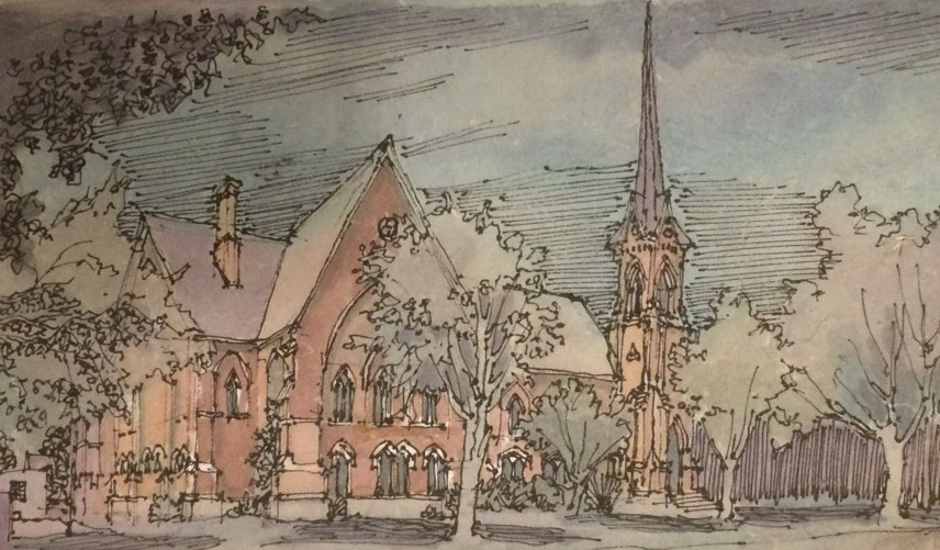 First Baptist Church of Fairport built in 1876. Later in the afternoon, we welcomed a couple aboard from a large, Michigan-bound sailing cruiser. We had an early dinner at a Mexican restaurant with a terrace overlooking the canal and a large population of yellow jackets! Fairport is a noisy place with long freight trains running hourly, loud music at bar terraces and contractors banging away at the Main Street bridge non-stop. Shauna asked the contractors how late they planned to work. When she was told “3:00 AM,” we decided to cruise to Bushnell’s Basin in hopes of more peace and quiet. Several cruisers were already tied up at the long floating dock at Bushnell’s Basin and docking was tricky but the other boaters helped with lines. The Town of Perinton built this dock in 2011 and operates it through the adjacent Marathon gas station. The dockmaster’s office is adjacent to one of the finest selections of beer on the canal. After connecting to shore power, we picked up ice and paid the nominal docking fee. Brent treated us to ice cream cones at a shop next to the canal. We played a few trivia games and turned in around 10:00 PM. AuthorMuddy Paddle grew up near the junction of the Hudson River and the Erie Canal. His deep interest in the canal goes back to childhood when a very elderly babysitter regaled him with stories about her childhood on the canal in the 1890s. Muddy spent his college years on the canal and spent many of his working years in a factory building overlooking the canal. Over the years he has traveled much of the canal system by boat and by bicycle. Muddy Paddle's Erie Canal adventure will return next Friday! To read other adventures by Muddy Paddle, see: Muddy Paddle: Able Seaman, about Muddy Paddle's adventures on the replica Half Moon, and Muddy Paddle's Excellent Adventure on the Hudson, about his canoe trip down the Hudson River.
The History Blog is supported by museum members and readers like you! Donate or join today! Editor’s Note: Welcome to the next episode in our 11-part account of Muddy Paddle's narrowboat trip through the Erie Canal and the Cayuga & Seneca Canal in western New York. The New York State Barge Canal system is in many ways a tributary of the Hudson River. It still connects the Great Lakes, the Finger Lakes, and Lake Champlain with the Atlantic Ocean by way of the Hudson River. Our contributing writer, Muddy Paddle, shares his experiences aboard the "Belle Mule." All the included illustrations are from his trip journal and sketchbooks. Day 6 - ThursdayWe had a peaceful night on the wall in Newark. Newark was once a substantial canal town, but there is little evidence of its historic role along the canal itself. The town developed at the site of Miller’s Basin and then absorbed the small settlement of Lockville to the east. Newark gained notoriety in 1848 when the Fox sisters began communicating with spirits in a small house north of town. Spiritualism became established as one of many new belief systems and utopian communities rising out of central New York’s “burned over district.” The Fox sisters’ house was moved to the Buffalo area by canalboat in 1915 and became a shrine at Lilydale. Lilydale remains a spiritualist center, but sadly the house was lost to fire in 1955. We visited the old canal stores at the site of Lockville with their stepped gable party walls and the distinctive rounded corner facing the canal and the preserved walls of old lock 59 nearby. 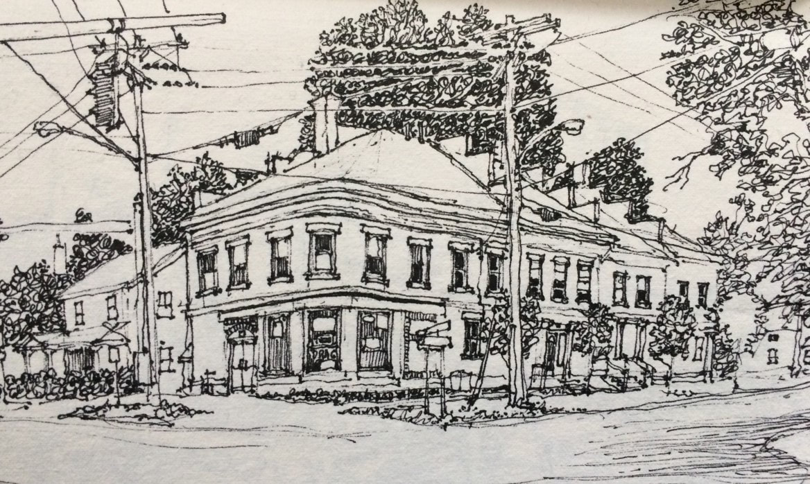 Mid-nineteenth century canal stores on Route 31 at the site of Lockville.  Old lock 59 at the site of Lockville. Fueled with Dunkin Donuts’ muffins, we got underway around 9:00 AM. A few raindrops fell, but it didn’t amount to anything. In less than an hour, we reached a broad, crescent shaped section of the canal at Port Gibson. Referred to as the “widewaters,” this lake-like stretch is picturesque and full of wildlife. A bridge and church spire were reflected in the still morning water. We approached Palmyra about an hour later. In spite of its proximity, Palmyra’s old business district and churches are not visible from the canal due to topography and trees. Palmyra was settled in the last decade of the eighteenth century. The principal streets were laid out in 1792 and a blockhouse was built to protect settlers in 1794. Located on the Ganargua Creek which permitted small boat navigation to Clyde River at Lyons, the place was originally referred to as Tolland or Swift’s Landing before being named for the ancient city of palms in Syria. It’s hard to imagine a less likely place name for this swampy and leafy place. The Montezuma Turnpike arrived from the Syracuse area in 1815. The Erie Canal was completed here in 1822 leading to an immediate development boom. Three boat basins and a drydock were built and a series of brick store buildings and houses were added to the burgeoning village before 1830. 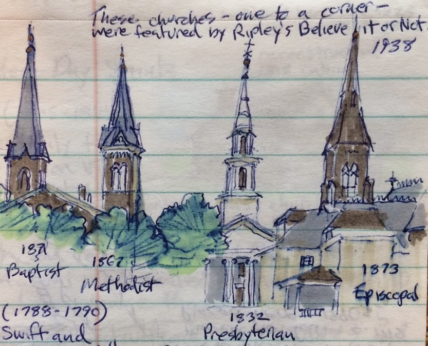 Church spires at Palmyra’s four corners. Palmyra was already an important commercial center when Joseph Smith published the Book of Mormon here in 1830 and founded the Church of Latter Day Saints. Smith and his followers were not welcome in Palmyra and moved west to Ohio in 1831. The church he founded eventually returned to the village and acquired his farm, the brick store building where the Book of Mormon was first published and of course Hill Cumorah where the 1400 year-old golden tablets were first revealed to Smith. These sites are preserved as touchstones of the Mormon faith and today draw many thousands of pilgrims from around the world. The village also features a remarkable ensemble of nineteenth century church architecture where Main Street and Church Street intersect. Four churches with prominent spires stand at each of the four corners almost like a four-poster bed. After passing beneath the Church St bridge, we tied up at the south wall near the approach to Lock E-29. As a courtesy, we radioed the lock to let the operator know that we would not be requesting a lift until later in the day. Our goal for the day was to experience the village and to visit Joseph Smith’s farm about two miles to the south. We untied our bicycles from the Belle’s cabin top and walked them over a bridge spanning the Ganargua Creek into Aqueduct Park. The park includes a scenic canal aqueduct built in 1857 and a change bridge built to facilitate the the movement of tow animals from one side of the canal to the other. After a long history in several locations, this particular bridge was reassembled here where its use can be interpreted. 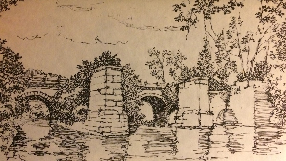 Ruins of the 1857 Erie Canal aqueduct over the Ganargua Creek in Palmyra. After riding past several tree-lined blocks of homes, we found ourselves in the countryside experiencing its smells and sounds. It was overcast, but we were grateful as we climbed the grade to the Joseph Smith farm without the sun beating down on us. Lora, who hadn’t been on a bike in many years, slowed down too much on the hill and tipped over into the ditch, spilling snacks out of her bag. She had a soft landing but looked around quickly to see if anyone noticed. We arrived at the Joseph Smith Farm visitor center and locked our bikes up at a picnic table. Almost all visitors come by car or bus, so our arrival was met with some curiosity. We were greeted by a senior couple from Colorado who serve as church elders and docents. The husband told us a little about himself and then summarized the early life of Joseph Smith and the founding of the Church of Later Day Saints before taking us on a long walking tour which included Smith’s two homes and the Sacred Grove. 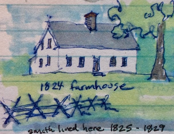 Restored Joseph Smith farmhouse in Palmyra. The farm had undergone an extensive restoration, taking it back to its appearance in the 1820s. This involved closing the old farm road and removing the pavement, building a bypass for modern vehicular traffic, recreating the 1818 Smith log cabin where Smith received his first visions and conducting an extensive restoration of the farmhouse where Smith lived between 1825 and 1829. All of this work was carefully informed by archaeologists and architectural historians based on extensive physical evidence. The investigations of the the farmhouse were so detailed that nail holes were matched and whitewashing gaps on interior boards revealed the original placement of furniture. Although we were presented with copies of the Book of Mormon at the conclusion of our tour, the docents were respectful; educating and not proselytizing. The majority of visitors are Mormon and their visits are conducted as spiritual journeys. 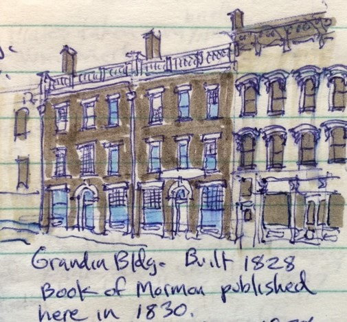 Restored Grandin Building in Palmyra. We rode our bikes back to the village in search of a quick lunch. We stopped at a pizza joint on East Main Street and as soon as Lora lost forward momentum, she tipped over again, skinning her knee. The pizza shop had outdoor picnic tables and was located across the street from the Grandin Building where the Book of Mormon was first published. This building has also been restored by the Church of Later Day Saints and is part of the pilgrimage made by faithful church members to Palmyra. After lunch, we stopped in several stores and visited the Alling Coverlet Museum. This is a small but outstanding museum dedicated to nineteenth century carpet coverlets and the process of weaving them using programmed designs on punch cards, predecessors of the computer punch cards of the 1960s and 1970s. As we were leaving, we encountered a mother and son, bicycling from Boston to the west coast. We were ashamed to have complained about our sore bottoms! We returned to our boat and made a dinner of grilled chicken, scalloped potatoes and asparagus and enjoyed it outdoors in a picnic pavilion. We watched a movie and called it a day. AuthorMuddy Paddle grew up near the junction of the Hudson River and the Erie Canal. His deep interest in the canal goes back to childhood when a very elderly babysitter regaled him with stories about her childhood on the canal in the 1890s. Muddy spent his college years on the canal and spent many of his working years in a factory building overlooking the canal. Over the years he has traveled much of the canal system by boat and by bicycle. Muddy Paddle's Erie Canal adventure will return next Friday! To read other adventures by Muddy Paddle, see: Muddy Paddle: Able Seaman, about Muddy Paddle's adventures on the replica Half Moon, and Muddy Paddle's Excellent Adventure on the Hudson, about his canoe trip down the Hudson River.
The History Blog is supported by museum members and readers like you! Donate or join today! Editor’s Note: Welcome to the next episode in our 11-part account of Muddy Paddle's narrowboat trip through the Erie Canal and the Cayuga & Seneca Canal in western New York. The New York State Barge Canal system is in many ways a tributary of the Hudson River. It still connects the Great Lakes, the Finger Lakes, and Lake Champlain with the Atlantic Ocean by way of the Hudson River. Our contributing writer, Muddy Paddle, shares his experiences aboard the "Belle Mule." All the included illustrations are from his trip journal and sketchbooks. Day 5 - WednesdayWe had a restful night on the wall in Seneca Falls and woke up with much anticipation for a day on the Erie Canal. We had heavy fog as we made our way across Lake Van Cleef and lined up our approach to the locks 2 and 3 of the Cayuga and Seneca Canal. The combined locks drop boats a total of 49 feet. The lock chambers were turbulent and I had an awful time with our transmission trying unsuccessfully to keep the boat in position. Everyone kept yelling at me to keep the boat in neutral including the lock tender. Neutral, however, was only a state of mind. When the big steel doors opened at the bottom of Lock 2, an eddy on the swollen and swift flowing Seneca River got a hold of the Belle and we needed full throttle to regain steering and control. Fortunately, full throttle worked just fine. We barreled down the Seneca River with the flood waters for three miles and then briefly entered the north end of Cayuga Lake before finding the approach to Lock 1 at the lake’s outlet. A south turn would have taken us up the lake 40 miles to Ithaca. We entered Lock 1 with a New York State Canals buoy tender. The lock operator was especially friendly and good natured and maintained manicured lawns and plantings around the lock. Shauna came up on deck to help with the stern line and I stayed put at the pedestal trying to maintain our position with the shift lever. When the lock opened, we travelled north on the Seneca River alongside the Montezuma Wildlife Refuge. The river was high and we noticed some flooding and several sunken docks. We passed beneath the New York State Thruway to a roundabout of waterways including the mouth of the Clyde River, a short channel leading to the west-bound Erie Canal, and a short channel carrying the Seneca River and east-bound Erie Canal. We turned right to take a look at the ruins of the 900-foot long Richmond Aqueduct completed on the enlarged Erie Canal in 1857. All but seven of the aqueduct’s 31 stone arches were dynamited in 1917 when the Barge Canal was completed and traffic was routed from the aqueduct to the river. This was one of the longest of the aqueducts on the Erie Canal and remains one the canal’s most impressive and scenic engineering monuments. 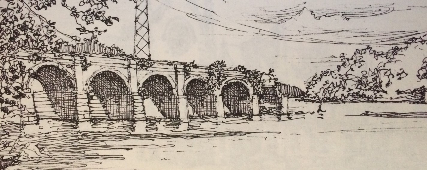 The ruins of the Richmond Aqueduct completed in 1857 and destroyed in 1917. We turned around and headed west on the Erie reaching Lock E-25 at May’s Point in a few minutes. May’s Point was a small tongue of dry land in the great Montezuma Swamp and an important landmark in the trackless swampland here for early travelers going west by boat and the workers forcing the original Erie Canal through the malarial swamps. Lock 25 features a steel arch gateway and remains an oasis surrounded by trees and lawns. After locking up, we traveled west along the artificially dug Barge Canal while observing the many channels and oxbows of the parallel Clyde River immediately to our south. We caught glimpses of the original but abandoned Erie Canal channel immediately to our north. We went through Lock E-26 just before arriving at the village of Clyde. 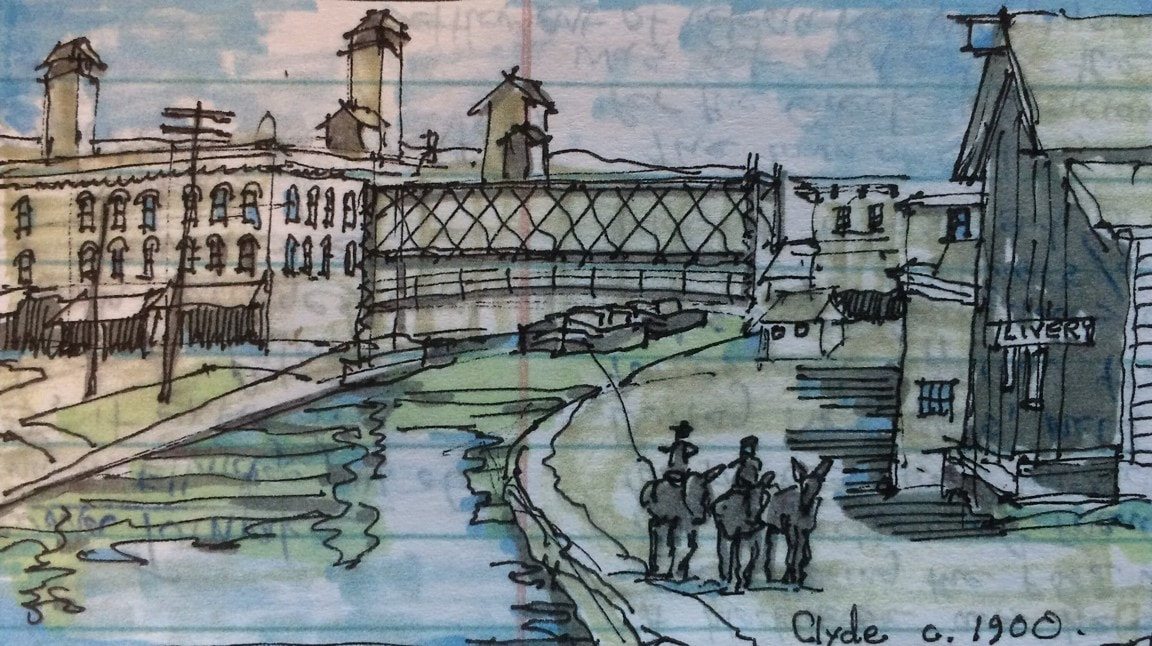 Clyde as it appeared around 1900 with canal boats passing beneath an open lift bridge. Clyde was settled in 1811 and named Lauraville in anticipation of our best friend Lora’s arrival aboard the Belle (just kidding of course!). A few years later, it was renamed Clyde by Scotsman Andrew McNab who also named the main business street Glasgow Street. The Erie Canal was built right through the settlement which became a bustling glass manufacturing center. When the Barge Canal was built in the early twentieth century, the old canal in town was abandoned and a new and larger channel was established a short distance to the south by straightening and dredging the Clyde River. There was a famous covered bridge over the river on Glasgow Street in the nineteenth century. We believe we observed one of its stone abutments as we continued our journey west. We continued along a heavily wooded stretch of canal interrupted by occasional and somewhat picturesque abandoned railroad bridge abutments festooned with grapevines and poison ivy. For about five miles, the canal parallels the old river with its tortured turns and loops which if traveled by boat would total ten or more miles. Shauna and Lora made soup and nachos for lunch. Soon, the village of Lyons came into view. Lyons was settled in 1789 at the fork of the head of the Clyde River where it was fed by the Canandaigua Outlet and the Ganargua or Mud Creek and named (tongue-in-cheek?) for the French city of Lyon at the fork of the Rhine and the Saone. Its French namesake seemed to have inspired architectural pretensions and the village subsequently developed a skyline with a domed courthouse, two substantial Gothic church towers with tall finials, and a three-story commercial block with a very fine wrought iron gallery at the corner. According to Rochester journalist Arch Merrill, 40 slaves were brought here from Maryland in 1797 to build a 1600 acre plantation for Daniel Dorsey complete with mansion and slave cabins. Lyons was established as the seat of Wayne County and its swampy lands became ideal for the culture of essential oils, particularly peppermint. Later in the nineteenth century, it became an important railroad town. The New York Central Railroad maintained car shops in Lyons until 1923. 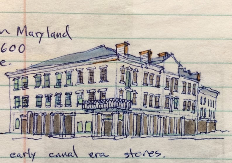 Erie Canal era stores in Lyons. We passed beneath the Geneva Street bridge and tied up on the wall near the approach to Lock E-27. The lock tender had already opened his gates to lock us up, so I called him on the radio to apologize and to let him know we were stopping in Lyons for a few hours. After connecting to shore power, we took a walk to the east side of town to visit the Trail of Hope. Aptly named, the serpentine trail and surrounding park were recently built by volunteers to offer children and the handicapped an opportunity to experience nature and to plant. We then walked into the town center where we visited the shops on William Street, got fresh coffee and searched unsuccessfully for some peppermint souvenirs. The Hotchkiss Essential Oils Company bottled peppermint oil here until about 20 years ago, shipping the concentrate in cobalt blue bottles and vials to candy and toothpaste manufacturers all over the world. One of their biggest customers was the Life Savers factory in Port Chester, NY, still decorated with larger-than-life peppermint Life Savers. The nineteenth century canal-side building has been preserved. 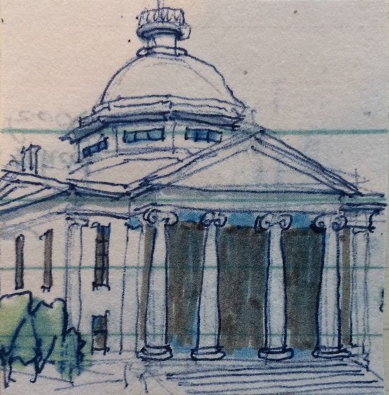 1854 Wayne County Courthouse We also went over to the courthouse square. One of the most sensational trials conducted in the Wayne County Courthouse was that of Oliver Curtis Perry who hijacked and robbed an express train in 1892 and made an escape by taking an idle locomotive away from the scene. He was chased, jumped off, stole a horse and sleigh, and then ran on foot. He was sentenced to 49 years, and later escaped from two prisons. The Utica Globe entitled its story of the trial “Startling Career, Desperate Deeds, Gifted Ruffian.” We returned to the Belle, and called the lock operator. He was at Lock E-28A and had to drive to E-27 to pass us west. After locking through, he drove back to E-28A to assist us there. Many lock operators manage two or more locks, shuttling between them by car or when close together by bicycle. Lock E-28A is located at the historic Lyons dry docks where canal tugs and barges are placed on blocks and repaired. Historic Dipper Dredge 3 sits in retirement here, a major artifact from the age of steam and the construction of the Barge Canal in the early twentieth century. The old “Poorhouse Lock” (old lock 56) from the 1840s is preserved here along with a brick canal store which is now a private residence. We could have spent at least an hour here, but the day was getting late and we were anxious to cover the few remaining miles to Newark. Several long freight trains ran parallel to the canal here and I was able to signal one in time for the engineer to blow the horn. We locked up through E-28B at the east end of Newark and docked on the wall in front of a village park with full boater services including showers and a laundromat. We had dinner at an Italian restaurant on Main Street. Back at the boat, Shauna baked cookies and we played a few rounds of Pictionary before calling it a night. AuthorMuddy Paddle grew up near the junction of the Hudson River and the Erie Canal. His deep interest in the canal goes back to childhood when a very elderly babysitter regaled him with stories about her childhood on the canal in the 1890s. Muddy spent his college years on the canal and spent many of his working years in a factory building overlooking the canal. Over the years he has traveled much of the canal system by boat and by bicycle. Muddy Paddle's Erie Canal adventure will return next Friday! To read other adventures by Muddy Paddle, see: Muddy Paddle: Able Seaman, about Muddy Paddle's adventures on the replica Half Moon, and Muddy Paddle's Excellent Adventure on the Hudson, about his canoe trip down the Hudson River.
The History Blog is supported by museum members and readers like you! Donate or join today! |
AuthorThis blog is written by Hudson River Maritime Museum staff, volunteers and guest contributors. Archives
July 2024
Categories
All
|
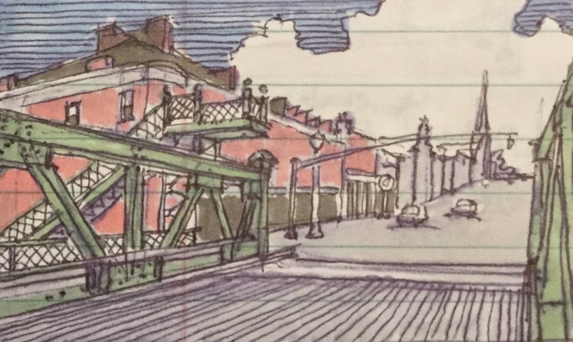
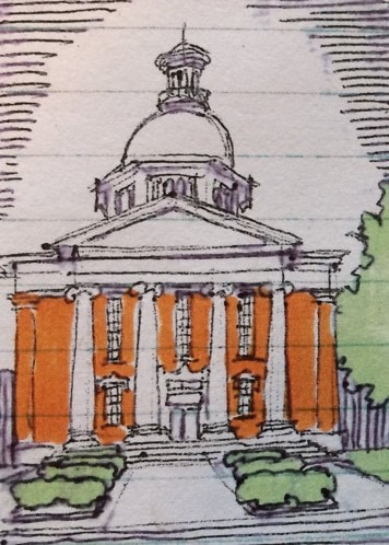
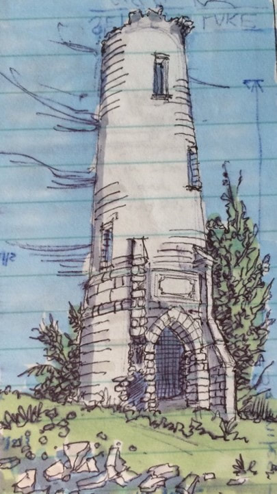
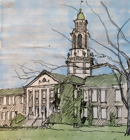
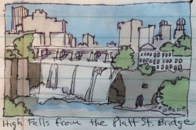
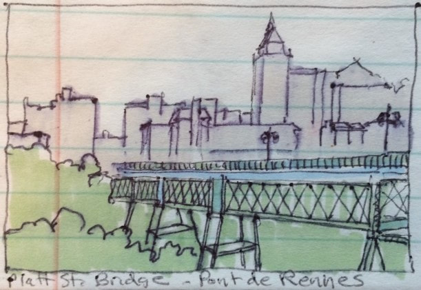
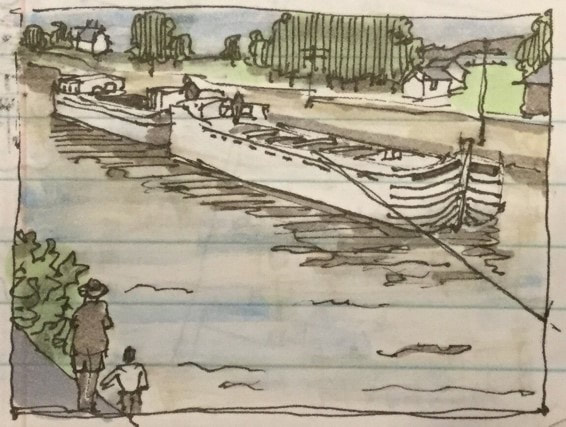
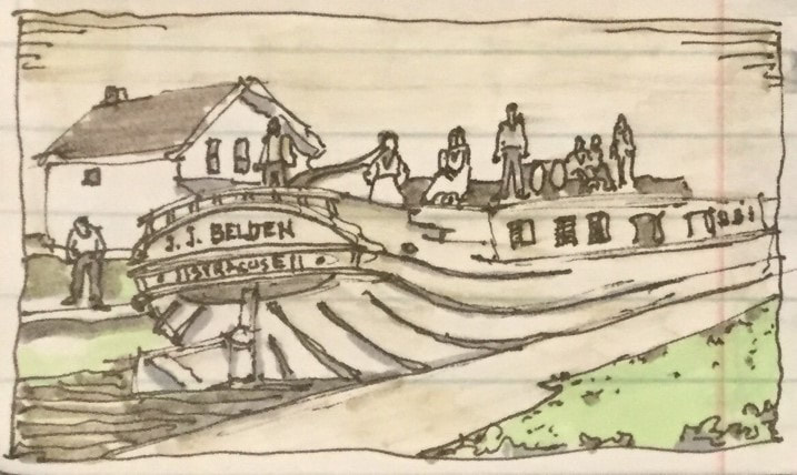
 RSS Feed