History Blog
|
|
|
Editor’s Note: Welcome to the next episode in our 11-part account of Muddy Paddle's narrowboat trip through the Erie Canal and the Cayuga & Seneca Canal in western New York. The New York State Barge Canal system is in many ways a tributary of the Hudson River. It still connects the Great Lakes, the Finger Lakes, and Lake Champlain with the Atlantic Ocean by way of the Hudson River. Our contributing writer, Muddy Paddle, shares his experiences aboard the "Belle Mule." All the included illustrations are from his trip journal and sketchbooks. Day 9 - Sunday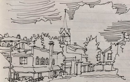 Vignette of Spencerport. The rain let up in the morning and I went out to do a little thumbnail sketch of the village (above). One of the locals was interested in what I was doing and came over to chat. He worked as a garbage man and told me that “he sees everything.” He noted that the white steeple in my sketch became the subject of a favorite photograph he produced when he saw it gleaming against a dark storm cloud. A hole in the cloud admitted a single shaft of blinding white light trained right on the church. He printed this image many times with different hues and colors and still considered it one of his best pieces. 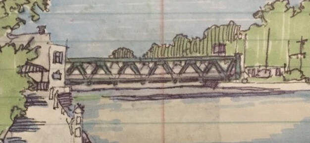 1915 Union St Lift Bridge in Spencerport. 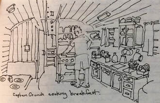 Galley aboard the "Belle" with Brent at the range. Galley aboard the "Belle" with Brent at the range. Brent manned the range and made frittatas for breakfast. After several reinforcing cups of hot coffee, we disconnected our shore power, cast off lines and headed west under the Union Street lift bridge. This is the first in a series of 15 similar lift bridges we will pass beneath, all built between 1910 and 1918. These bridges were a practical necessity for many canal town business districts where obtaining sufficient vertical clearance for tugboats and motor ships with conventional fixed spans would have required long approaches blocking access to essential stores and businesses situated in close proximity to the canal. The bridges are built with riveted Warren trusses and rise and fall on four legs placed in caissons. The caisson on one side features an electric motor and a counterweight approximating the dead weight of the bridge. Cables linking the legs together beneath the bridge deck transmit the lift equally to all four legs. The bridges typically feature an operator’s tower with good visual range up and down the canal, stairs that allow pedestrians to cross when the deck is raised, crossing gates and signal lights to stop traffic and a clanging bell to alert everyone that the bridge is in motion. They are a defining feature of the western portion of the canal for both the boaters and the towns.  1915 Main Street lift bridge at Brockport. We reached a second lift bridge about 30 minutes later in Adams Basin. Adams Basin, once a port for warehousing and shipping agricultural products is now quiet with only a few houses and barns. A mid-nineteenth century canal inn survives on the north bank of the canal and was fittingly used until recently as a bed and breakfast. The bridge operator spoke with us on channel 13 and was ready for us when we arrived. There was no traffic to disrupt here. As we continued west, he pleasantly transmitted “Have a nice day, captain.” Today’s destination is Brockport. Docking is situated between two lift bridges and unlike Adams Basin, both carry plenty of traffic. The bridge operator shuttles between the two bridges by bicycle. We called ahead to let her know that we needed to pass under the Park Avenue bridge but not the Main Street bridge. Appreciating the heads-up, the bridge was already up as we approached with plenty of cars backed up. Other boats were on the wall at Harvester Park and we had a tricky piece of parallel parking to perform to claim our space. Brockport was founded in 1823 when it briefly served as the western terminus of the Erie Canal. Heil Brockway built packet boats here and operated a successful line between Rochester and Buffalo soon after the canal was completed. A college was established here in 1841 which evolved into today’s State University College at Brockport, the institution that now dominates the village economy and culture. And in 1846, Cyrus McCormick, founder of International Harvester, produced the first successful mechanical harvesters in the world at a Brockport foundry, hence the appellation “Harvester Park.” 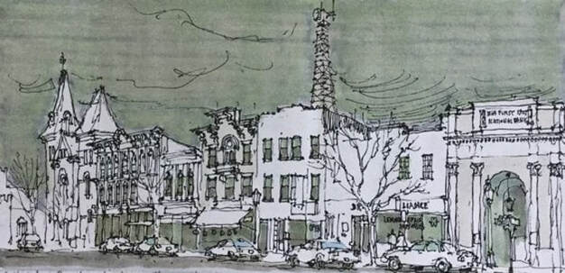 Main Street, Brockport. In many ways, Brockport is the quintessential canal town. Its Main Street is perpendicular to the canal and lined by two and three story brick commercial blocks with cast iron storefronts and bracketed cornices. Steepled churches rise up around the fringe of the business district. Brick and frame houses fill out the blocks more distant from the canal and the college campus stretches west from the residential neighborhoods to farm fields outside of the old village. A modern area of banks, supermarkets and fast food is located about a mile south of the canal. The banks of the canal were lined with livery stables and storage buildings, several of which remain and are now used for businesses and restaurants. The village is keenly aware of its history and has pioneered a “museum without walls.” Street signs are custom made with silhouettes of canal boats, trains and trolleys. The presence of the college has supported restaurants, local brewing, coffee shops, a really nice bookstore and even a symphony orchestra! We removed our bikes and set off to visit the 1894 Soldiers Memorial about a mile east of the village. After the Civil War, a local initiative got underway to establish a veterans’ cemetery in town. Following the philosophy that “if you build it, they will come,” a chapel, vault and observation tower were built to promote the project. Only several veterans were buried before the project petered out. The Gothic-styled tower with a spiral staircase to an observation gallery was neglected but survived for decades and became a destination for many college students. By the 1970s, the spiral stairs were mainly broken and the gallery had begun to collapse. In recent years, the tower was stabilized without the gallery and rededicated. We had a little difficulty finding the site off Owens Road but got help from neighbors who directed us to a hill behind a fire station. The truncated tower is now well cared for and well worth looking for.
We remounted our bikes and rode into the village and then over to the college campus for a little tour. The town and campus are compact and pedestrian friendly. We checked out menus at several restaurants and decided to return in the evening to a place in an old canal building next to the Main Street lift bridge. After putting our bikes back on the boat, we decided to make a short three-mile boat trip to Holley to visit the canal park and waterfall. Holley is a small town built around a large square surrounded by two and three-story commercial buildings with cast iron storefronts. A Romanesque style campanile of a former church presides at the head of the table so-to-speak. The canal by-passed the square in 1856 and today, only the East Avenue lift bridge suggests the presence of a town while transiting the canal. We docked at the canal park, and planned to picnic at the gazebo, but a young Marine in his dress blues and his bride were there for photographs as we carried lunch off the boat. 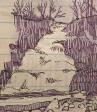 Waterfall at Holley. Waterfall at Holley. We found a picnic pavilion nearby and decamped there. After lunch, a couple of kids showed us the way to the waterfall. The waterfall is associated with a waste weir or spillway on the canal. After cascading down a steep, rocky bank, excess canal water flows into a creek which then flows north into a culvert and under the canal. We returned to Brockport, walked around Main Street and Market Street and had a pleasant dinner alongside the canal. After dinner, we went out for ice. In the evening we played a trivia game. We had a restless night on the wall. It began with a couple of loud drunkards on the opposite bank of the canal sitting on a park bench and repeatedly asking “eh?” followed by colorful but innumerable f-bombs. Voices really carry over the water. Later, a deranged duck relentlessly pecked the Belle’s steel hull waterline in search of mussels. I woke up early, wrote in my journal and went back to bed for a few more hours. AuthorMuddy Paddle grew up near the junction of the Hudson River and the Erie Canal. His deep interest in the canal goes back to childhood when a very elderly babysitter regaled him with stories about her childhood on the canal in the 1890s. Muddy spent his college years on the canal and spent many of his working years in a factory building overlooking the canal. Over the years he has traveled much of the canal system by boat and by bicycle. Muddy Paddle's Erie Canal adventure will return next Friday! To read other adventures by Muddy Paddle, see: Muddy Paddle: Able Seaman, about Muddy Paddle's adventures on the replica Half Moon, and Muddy Paddle's Excellent Adventure on the Hudson, about his canoe trip down the Hudson River.
The History Blog is supported by museum members and readers like you! Donate or join today!
0 Comments
Editor’s Note: Welcome to the next episode in our 11-part account of Muddy Paddle's narrowboat trip through the Erie Canal and the Cayuga & Seneca Canal in western New York. The New York State Barge Canal system is in many ways a tributary of the Hudson River. It still connects the Great Lakes, the Finger Lakes, and Lake Champlain with the Atlantic Ocean by way of the Hudson River. Our contributing writer, Muddy Paddle, shares his experiences aboard the "Belle Mule." All the included illustrations are from his trip journal and sketchbooks. Day 8 - Saturday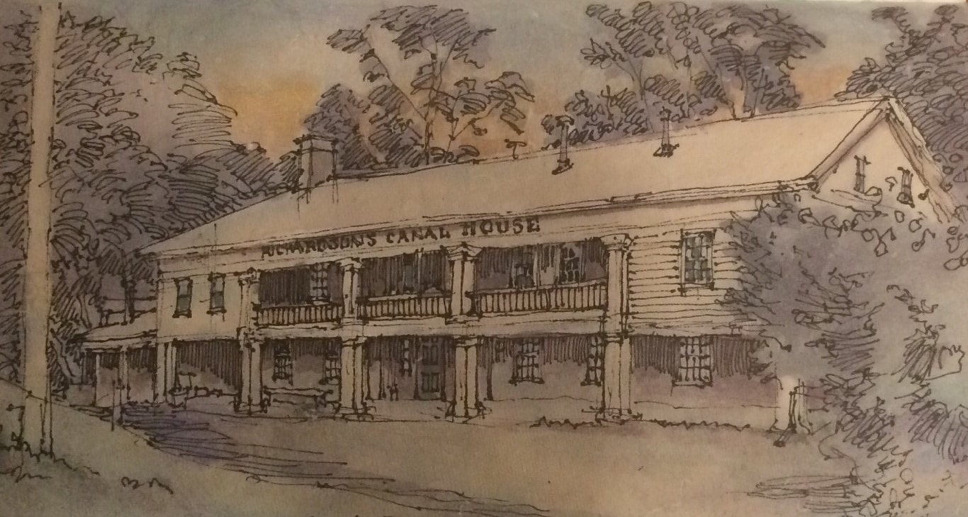 The old Bushnell’s Basin canal inn established in 1818. Bushnell’s Basin is a small hamlet just west of I-490 and east of the Irondequoit Creek. It was settled before the canal arrived and manufactured gunpowder and milled lumber. An inn was established in 1818 and after a long decline briefly became a nudist retreat. The inn was rescued from oblivion in the 1970s. Richardson’s CanalHouse became a high-end restaurant for Rochester area diners. Located a few feet below the canal berm, it is also an exceptional example of early-nineteenth century architecture. I was up before dawn in hopes of sketching the inn. It was chilly and damp. Sketching in the dark is literally sketchy, but under a street lamp, I was able to rough the outline of the building and its wooded setting. As the sky lightened, I was able to add some detail and color. Brent caught up with me, and we walked into the hamlet to get strong coffee and a bag of really good bagels. After breakfast, we said goodbye to our neighboring boaters, used the bow thruster to extricate the Belle from the adjacent boats and headed west over a very historic stretch of the canal known as the Great Embankment, an earthen berm elevating the canal above the Irondequoit Creek and valley. The first iteration of this high embankment was built between 1818 and 1822 and was heroically built with wheelbarrows and shovels, raising the canal high above the surrounding countryside. It has been widened and reinforced a number of times, notably after devastating failures in 1912 and 1974 which flooded the lands below. Vegetation has grown up along the sides of the embankment, but between gaps in the trees, one can still see fields well below the grade of the canal. We entered Pittsford about ten minutes later. Pittsford is a pretty village with fine early nineteenth century architecture including the old Phoenix Hotel completed around 1820. Over the years, this hotel hosted DeWitt Clinton, Lafayette, Daniel Webster and Cornelius Vanderbilt among others. In the twentieth century Pittsford became a suburb of the growing city of Rochester. The historic buildings of the village are treasured and protected. The docks here were full of boaters, making even a short visit impossible.  The former Phoenix Hotel in Pittsford. On the west side of Pittsford, we could see the stub of a short channel where the Erie Canal bent north along its original path into downtown Rochester. The Barge Canal, built between 1905 and 1918 bypassed downtown Rochester. Demolition necessary for widening would have been too costly and disruptive. The canal was already snarling traffic as downtown lift bridges were constantly being raised and lowered, closing critical city streets each time. We locked up through E-32 and E-33 which are situated in close proximity to each other just south of Brighton. We passed through about four miles of urban sprawl, malls, ugly highway bridges, and incessant traffic noise before reaching the relative quiet of Genesee Valley Park and our intersection with the Genesee River. The Genesee River flows north from the cavernous valley now occupied by Letchworth State Park to the High Falls in downtown Rochester before emptying into Lake Ontario. The falls were a major source of water power and sprouted mills in the early years of the nineteenth century. Once the Erie Canal arrived and provided the means to ship grain in bulk inexpensively to Albany and New York, Rochester exploded in population and industry, growing from a population of 2,500 in 1821 to 13,500 in 1834. The river south of the city is languid and curving with park-like banks. 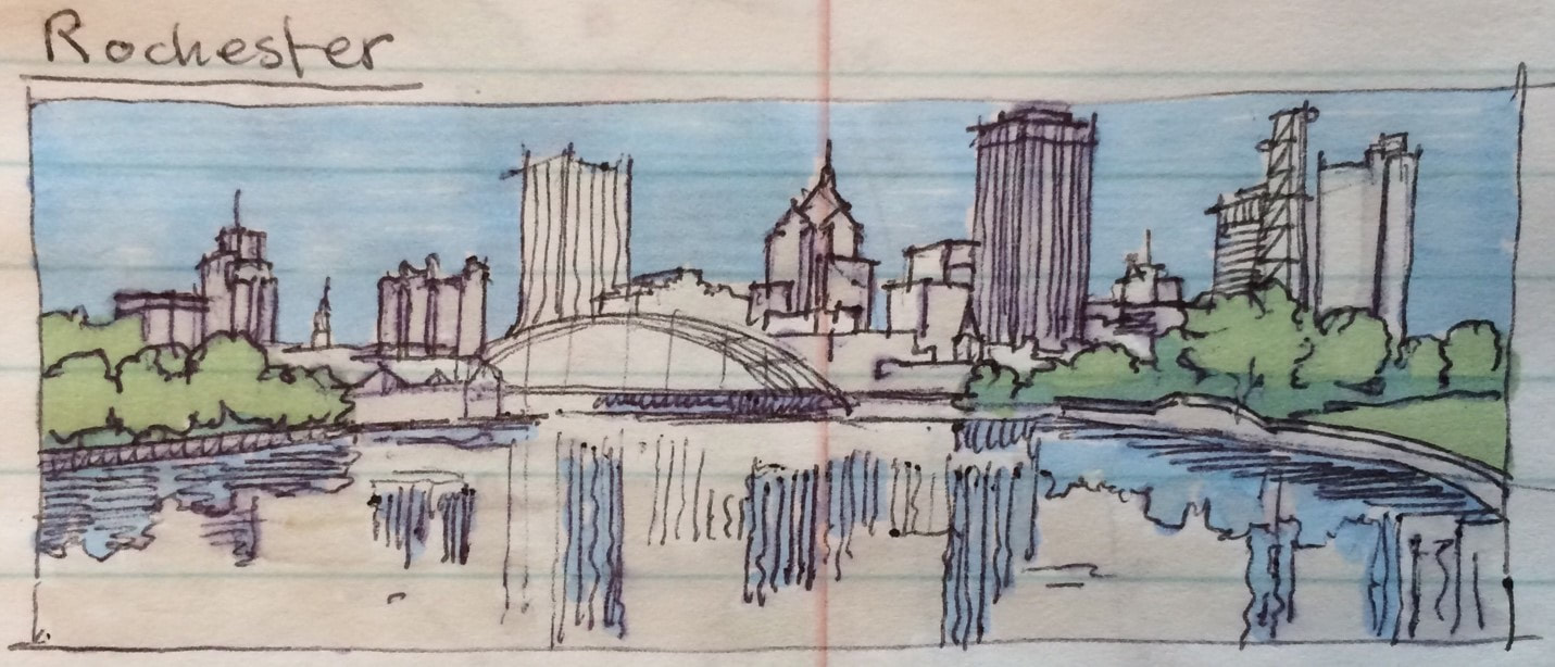 The Genesee River approaching downtown Rochester with the arched Frederick Douglass and Susan B. Anthony Bridge. We encountered kayakers at the Genesee Waterway Center listening to music with earphones and unaware of our approach, so the Belle slowed to a crawl to avoid each of them. We passed the University of Rochester’s riverside chapel and passed beneath several city bridges before reaching the Corn Hill Landing. Just ahead was the Court Street dam and the end of navigation. Beyond the dam, the river is shallow, rocky and swift as it passes through downtown and over the precipice at High Falls. We found plenty of room at the landing, tied up, locked up our boat and set off on foot to explore a little of Rochester. Our first destination was the 1842 Erie Canal aqueduct over the Genesee River, the second one built at the site. After the Barge Canal bypassed downtown, the stone-arched structure was modified in 1924 to carry subway trains through the trough of the closed canal while a second series of arches carried vehicular traffic above on what became Broad Street. The subway is gone and some canal aficionados still dream of watering the aqueduct for small boats. Other stone arch bridges remain over the river. The Main Street Bridge north of the canal was once lined by stores along the lines of the Pons de Vecchio in Florence so that walking down Main Street, there was no awareness of crossing over the powerful river. The stores were removed during urban renewal destroying this interesting anachronism but restoring a visual connection to the river. 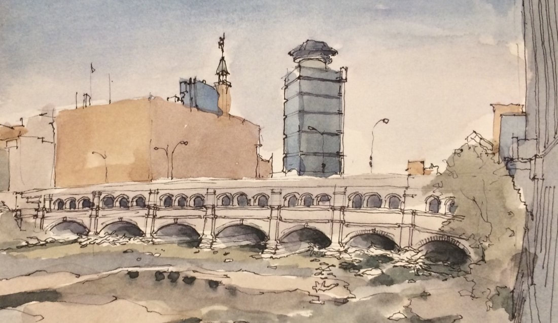 1842 Erie Canal aqueduct now supporting Broad St. in downtown Rochester. 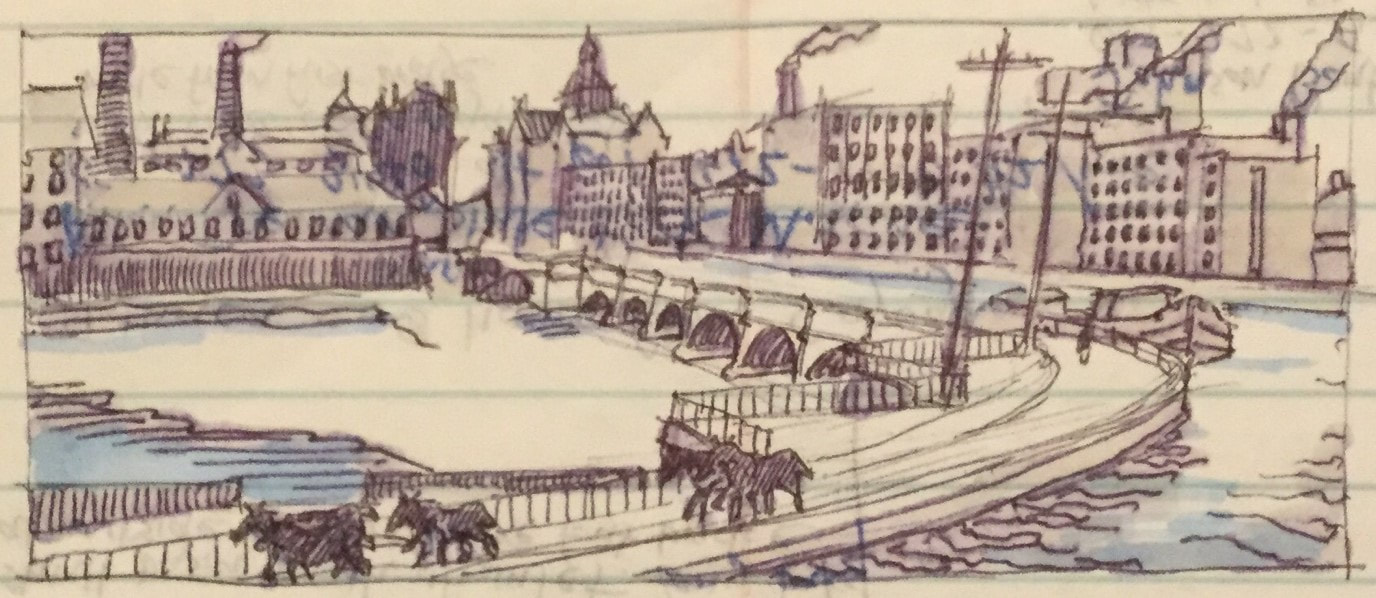 The 1842 Genesee River aqueduct in use before downtown Rochester was by-opassed by the NYS Barge Canal. We walked up State Street and the wedding cake-like Powers building toward the High Falls district north of downtown. We explored Brown’s Race and the stone ruins of the Triphammer forge before walking over the high Platt Street Bridge where we got a good look at the High Falls on the Genesee. Here, just beyond utilitarian rail and highway bridges, the river falls 100 feet straight over a cliff into a limestone chasm, pock marked by hydraulic tunnels once associated with the thriving milling industry. It was here on Friday the 13th of November 1829 that Sam Patch, popularly known as the “Jersey Jumper” attempted to jump the falls before 8000 spectators, weeks after successfully conquering Niagara Falls. He failed to surface and his frozen body was discovered months later near the river’s mouth.
We attempted to get lunch at the Genesee Brewery on Cataract Street, but the line was long and we were anxious to return to our boat and find a quiet place to tie up for the night before it got dark. We met a couple from Texas with a smaller version of our boat tied up right behind us. They recently purchased it from the rental company in Macedon and they invited us to take a tour. We were impressed! We got underway and headed up the river to the junction with the canal. Lora and Shauna made sandwiches and upon reaching the four corners of the river and canal, we turned west with hopes of reaching Spencerport for the evening. During the first hour, we passed through a channel cut straight through layers of limestone. This channel was bridged by about a dozen structures including highway bridges and a series of massive steel railroad bridges, most of which were abandoned. In Gates, at the western end of the rock cut, we re-entered the path of the original Erie Canal at Junction Lock. Here, the other stub of the original canal coming out of downtown Rochester remains. Quite a few folks in this area use the towpath for dog walking, jogging and photography. Brent drove the boat the remainder of the way to Spencerport. The canal here passed through open fields and woods. One farm appeared to have found a new life as a wedding venue. After passing an abandoned dormitory barge, two fisherman darted out of a hidden boat basin into our path without looking and Brent had to throw the Belle into reverse in order to avoid running them over. We arrived in Spencerport just before dark. Our boater friends from Bushnell’s Basin were here with a campfire and warily watched us dock our big, clumsy steel boat next to their fiberglass cruiser. They took our lines and exclaimed wryly that we were like “dog s--t on the bottom of their shoes.” We responded by picking up a six-pack of locally-brewed “Too Kind” beer for them at the in-town grocery. It began to rain. We buttoned up the Belle, prepared leftovers for supper and played a trivia game. Brent is very competitive and we got loud enough to probably annoy our friends and a few other boaters. After a few off-color outbursts, we figured it would be best to call it a day. It rained hard but we had a dry and restful night. AuthorMuddy Paddle grew up near the junction of the Hudson River and the Erie Canal. His deep interest in the canal goes back to childhood when a very elderly babysitter regaled him with stories about her childhood on the canal in the 1890s. Muddy spent his college years on the canal and spent many of his working years in a factory building overlooking the canal. Over the years he has traveled much of the canal system by boat and by bicycle. Muddy Paddle's Erie Canal adventure will return next Friday! To read other adventures by Muddy Paddle, see: Muddy Paddle: Able Seaman, about Muddy Paddle's adventures on the replica Half Moon, and Muddy Paddle's Excellent Adventure on the Hudson, about his canoe trip down the Hudson River.
The History Blog is supported by museum members and readers like you! Donate or join today! Editor’s Note: Welcome to the next episode in our 11-part account of Muddy Paddle's narrowboat trip through the Erie Canal and the Cayuga & Seneca Canal in western New York. The New York State Barge Canal system is in many ways a tributary of the Hudson River. It still connects the Great Lakes, the Finger Lakes, and Lake Champlain with the Atlantic Ocean by way of the Hudson River. Our contributing writer, Muddy Paddle, shares his experiences aboard the "Belle Mule." All the included illustrations are from his trip journal and sketchbooks. Day 7 - FridayIt was a sunny and cloudless morning and we spent a few relaxing hours getting organized and making breakfast. It is Lora and Brent’s anniversary so Brent went out to pick a pink wildflower for Lora for the breakfast table. We called the lock operator at E-29 and cast off lines around 9:00 AM, entering the lock almost immediately. After about a mile, we stopped at a dock to look at the ruins of old lock 60 built in 1841 and now maintained as a park. When we got underway again, Shauna and Lora set up folding lawn chairs in the bow and just enjoyed the sun and the unfolding landscapes and wildlife. By now they had learned that the ducks would always swim aside at the last minute as we approached. Yelling back to the guy at the helm was not necessary.
We continued west to Macedon and locked up at E-30. Macedon, named for Alexander the Great’s homeland, is a small canal town once prominent in the manufacturing of seed drills. Today, it is the home of Erie Canal Adventures, a canalboat rental company and marina. The facility is situated around a basin on the west end of town where several freshly painted red and green narrow boats are ready for the next renters. Previously owned by Peter Wiles who introduced these boats to the Barge Canal, the company still takes pride in maintaining their fleet and making trips enjoyable for their customers. An enormous thunderstorm blew up as we approached a wide section of the canal which came to be known as Wayneport. Towering clouds ominously darkened the sky as thunder boomed. Heavy rain and a brief pelting of hail reduced our visibility and we slowed to a crawl hoping to avoid the canal banks or any approaching boats. The storm passed over quickly and the temperature dropped about 20 degrees. We had planned to visit the Union Burying Ground here where canal laborers with smallpox were buried, but we had passed the bridge at Wayneport Road and decided not to turn back. Three miles later, we entered Fairport. 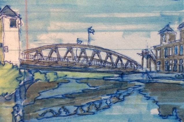 The 1914 Main Street Lift Bridge in Fairport. Fairport is a substantial canal town and boater mecca. Esplanades have been created between a high truss road bridge at the east edge of downtown and the 1914 Main Street Lift Bridge at the center. This area is lined with restaurants, shops and expensive fiberglass cruisers. The village developed in the mid-nineteenth century and industries included the packing and export of fruit and vinegar. The predecessor of the American Can Company got its start here and in spite of extensive urban renewal, a few factory buildings and brick chimneys remain. We spent the afternoon here getting lunch food, exploring the shops, and taking luxurious showers at the boater welcome center. Shauna and Lora made dinner reservations, Brent took a ten-mile bike ride along the towpath, and I met Paul, an 81-year old artist who was painting a local tour boat and its reflection on the canal. I walked up to Fairport Road, the main east-west highway here and sketched an interesting Victorian Gothic church with a very spiky steeple while sitting on a bus stop bench. An elderly woman joined me on the bench while waiting for the Rochester bus. Clearly annoyed that she had to share the bench with me she asked, “why don’t you just take a picture with your cell phone and go?” 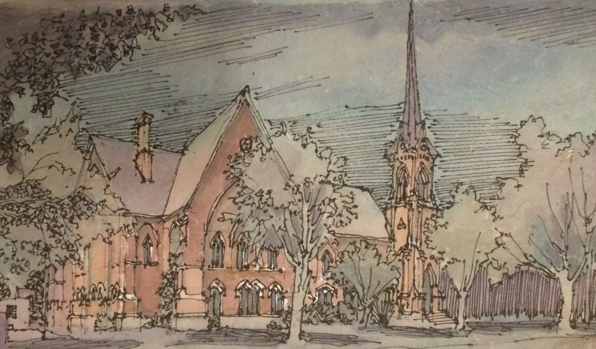 First Baptist Church of Fairport built in 1876. Later in the afternoon, we welcomed a couple aboard from a large, Michigan-bound sailing cruiser. We had an early dinner at a Mexican restaurant with a terrace overlooking the canal and a large population of yellow jackets! Fairport is a noisy place with long freight trains running hourly, loud music at bar terraces and contractors banging away at the Main Street bridge non-stop. Shauna asked the contractors how late they planned to work. When she was told “3:00 AM,” we decided to cruise to Bushnell’s Basin in hopes of more peace and quiet. Several cruisers were already tied up at the long floating dock at Bushnell’s Basin and docking was tricky but the other boaters helped with lines. The Town of Perinton built this dock in 2011 and operates it through the adjacent Marathon gas station. The dockmaster’s office is adjacent to one of the finest selections of beer on the canal. After connecting to shore power, we picked up ice and paid the nominal docking fee. Brent treated us to ice cream cones at a shop next to the canal. We played a few trivia games and turned in around 10:00 PM. AuthorMuddy Paddle grew up near the junction of the Hudson River and the Erie Canal. His deep interest in the canal goes back to childhood when a very elderly babysitter regaled him with stories about her childhood on the canal in the 1890s. Muddy spent his college years on the canal and spent many of his working years in a factory building overlooking the canal. Over the years he has traveled much of the canal system by boat and by bicycle. Muddy Paddle's Erie Canal adventure will return next Friday! To read other adventures by Muddy Paddle, see: Muddy Paddle: Able Seaman, about Muddy Paddle's adventures on the replica Half Moon, and Muddy Paddle's Excellent Adventure on the Hudson, about his canoe trip down the Hudson River.
The History Blog is supported by museum members and readers like you! Donate or join today! Editor’s Note: Welcome to the next episode in our 11-part account of Muddy Paddle's narrowboat trip through the Erie Canal and the Cayuga & Seneca Canal in western New York. The New York State Barge Canal system is in many ways a tributary of the Hudson River. It still connects the Great Lakes, the Finger Lakes, and Lake Champlain with the Atlantic Ocean by way of the Hudson River. Our contributing writer, Muddy Paddle, shares his experiences aboard the "Belle Mule." All the included illustrations are from his trip journal and sketchbooks. Day 6 - ThursdayWe had a peaceful night on the wall in Newark. Newark was once a substantial canal town, but there is little evidence of its historic role along the canal itself. The town developed at the site of Miller’s Basin and then absorbed the small settlement of Lockville to the east. Newark gained notoriety in 1848 when the Fox sisters began communicating with spirits in a small house north of town. Spiritualism became established as one of many new belief systems and utopian communities rising out of central New York’s “burned over district.” The Fox sisters’ house was moved to the Buffalo area by canalboat in 1915 and became a shrine at Lilydale. Lilydale remains a spiritualist center, but sadly the house was lost to fire in 1955. We visited the old canal stores at the site of Lockville with their stepped gable party walls and the distinctive rounded corner facing the canal and the preserved walls of old lock 59 nearby.  Mid-nineteenth century canal stores on Route 31 at the site of Lockville.  Old lock 59 at the site of Lockville. Fueled with Dunkin Donuts’ muffins, we got underway around 9:00 AM. A few raindrops fell, but it didn’t amount to anything. In less than an hour, we reached a broad, crescent shaped section of the canal at Port Gibson. Referred to as the “widewaters,” this lake-like stretch is picturesque and full of wildlife. A bridge and church spire were reflected in the still morning water. We approached Palmyra about an hour later. In spite of its proximity, Palmyra’s old business district and churches are not visible from the canal due to topography and trees. Palmyra was settled in the last decade of the eighteenth century. The principal streets were laid out in 1792 and a blockhouse was built to protect settlers in 1794. Located on the Ganargua Creek which permitted small boat navigation to Clyde River at Lyons, the place was originally referred to as Tolland or Swift’s Landing before being named for the ancient city of palms in Syria. It’s hard to imagine a less likely place name for this swampy and leafy place. The Montezuma Turnpike arrived from the Syracuse area in 1815. The Erie Canal was completed here in 1822 leading to an immediate development boom. Three boat basins and a drydock were built and a series of brick store buildings and houses were added to the burgeoning village before 1830.  Church spires at Palmyra’s four corners. Palmyra was already an important commercial center when Joseph Smith published the Book of Mormon here in 1830 and founded the Church of Latter Day Saints. Smith and his followers were not welcome in Palmyra and moved west to Ohio in 1831. The church he founded eventually returned to the village and acquired his farm, the brick store building where the Book of Mormon was first published and of course Hill Cumorah where the 1400 year-old golden tablets were first revealed to Smith. These sites are preserved as touchstones of the Mormon faith and today draw many thousands of pilgrims from around the world. The village also features a remarkable ensemble of nineteenth century church architecture where Main Street and Church Street intersect. Four churches with prominent spires stand at each of the four corners almost like a four-poster bed. After passing beneath the Church St bridge, we tied up at the south wall near the approach to Lock E-29. As a courtesy, we radioed the lock to let the operator know that we would not be requesting a lift until later in the day. Our goal for the day was to experience the village and to visit Joseph Smith’s farm about two miles to the south. We untied our bicycles from the Belle’s cabin top and walked them over a bridge spanning the Ganargua Creek into Aqueduct Park. The park includes a scenic canal aqueduct built in 1857 and a change bridge built to facilitate the the movement of tow animals from one side of the canal to the other. After a long history in several locations, this particular bridge was reassembled here where its use can be interpreted. 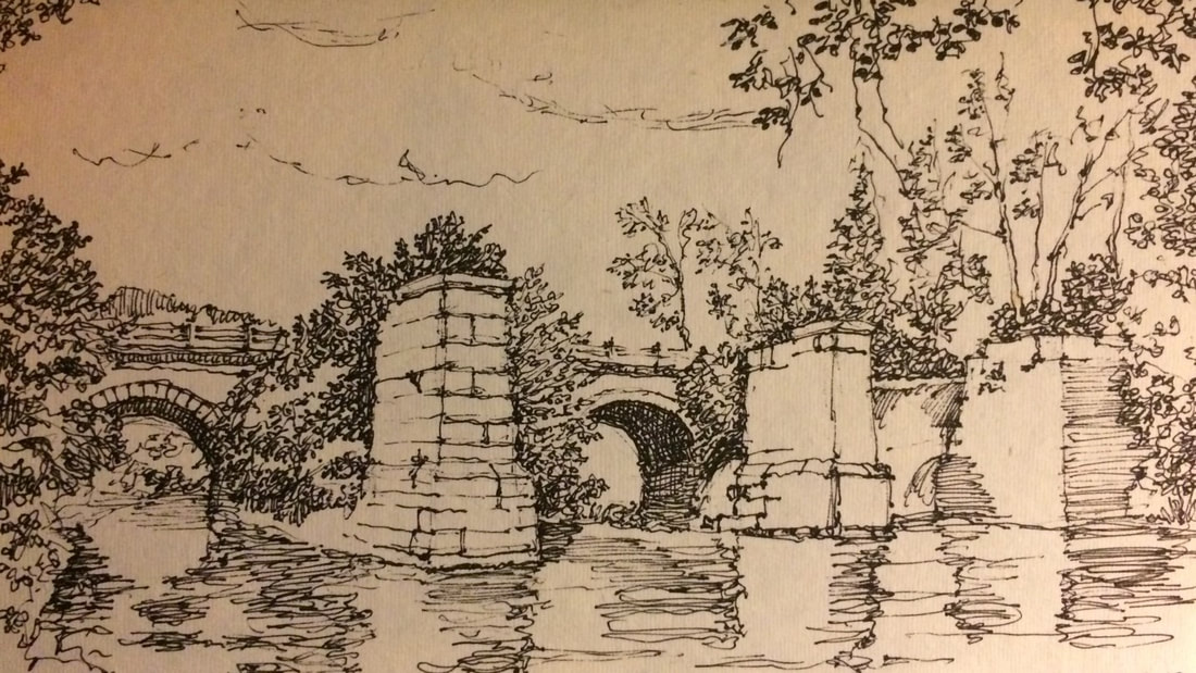 Ruins of the 1857 Erie Canal aqueduct over the Ganargua Creek in Palmyra. After riding past several tree-lined blocks of homes, we found ourselves in the countryside experiencing its smells and sounds. It was overcast, but we were grateful as we climbed the grade to the Joseph Smith farm without the sun beating down on us. Lora, who hadn’t been on a bike in many years, slowed down too much on the hill and tipped over into the ditch, spilling snacks out of her bag. She had a soft landing but looked around quickly to see if anyone noticed. We arrived at the Joseph Smith Farm visitor center and locked our bikes up at a picnic table. Almost all visitors come by car or bus, so our arrival was met with some curiosity. We were greeted by a senior couple from Colorado who serve as church elders and docents. The husband told us a little about himself and then summarized the early life of Joseph Smith and the founding of the Church of Later Day Saints before taking us on a long walking tour which included Smith’s two homes and the Sacred Grove. 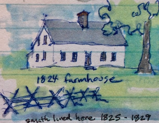 Restored Joseph Smith farmhouse in Palmyra. The farm had undergone an extensive restoration, taking it back to its appearance in the 1820s. This involved closing the old farm road and removing the pavement, building a bypass for modern vehicular traffic, recreating the 1818 Smith log cabin where Smith received his first visions and conducting an extensive restoration of the farmhouse where Smith lived between 1825 and 1829. All of this work was carefully informed by archaeologists and architectural historians based on extensive physical evidence. The investigations of the the farmhouse were so detailed that nail holes were matched and whitewashing gaps on interior boards revealed the original placement of furniture. Although we were presented with copies of the Book of Mormon at the conclusion of our tour, the docents were respectful; educating and not proselytizing. The majority of visitors are Mormon and their visits are conducted as spiritual journeys. 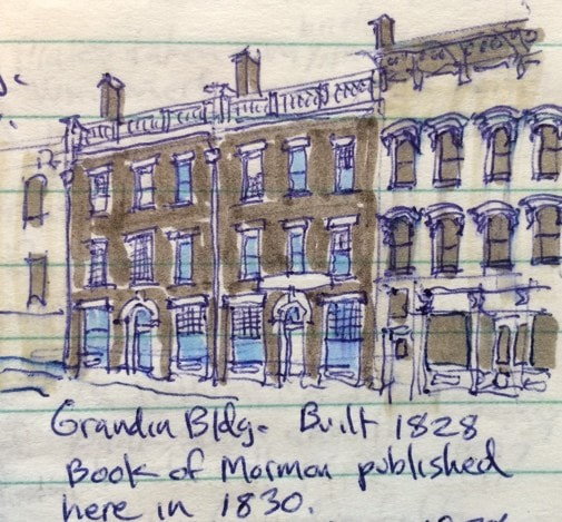 Restored Grandin Building in Palmyra. We rode our bikes back to the village in search of a quick lunch. We stopped at a pizza joint on East Main Street and as soon as Lora lost forward momentum, she tipped over again, skinning her knee. The pizza shop had outdoor picnic tables and was located across the street from the Grandin Building where the Book of Mormon was first published. This building has also been restored by the Church of Later Day Saints and is part of the pilgrimage made by faithful church members to Palmyra. After lunch, we stopped in several stores and visited the Alling Coverlet Museum. This is a small but outstanding museum dedicated to nineteenth century carpet coverlets and the process of weaving them using programmed designs on punch cards, predecessors of the computer punch cards of the 1960s and 1970s. As we were leaving, we encountered a mother and son, bicycling from Boston to the west coast. We were ashamed to have complained about our sore bottoms! We returned to our boat and made a dinner of grilled chicken, scalloped potatoes and asparagus and enjoyed it outdoors in a picnic pavilion. We watched a movie and called it a day. AuthorMuddy Paddle grew up near the junction of the Hudson River and the Erie Canal. His deep interest in the canal goes back to childhood when a very elderly babysitter regaled him with stories about her childhood on the canal in the 1890s. Muddy spent his college years on the canal and spent many of his working years in a factory building overlooking the canal. Over the years he has traveled much of the canal system by boat and by bicycle. Muddy Paddle's Erie Canal adventure will return next Friday! To read other adventures by Muddy Paddle, see: Muddy Paddle: Able Seaman, about Muddy Paddle's adventures on the replica Half Moon, and Muddy Paddle's Excellent Adventure on the Hudson, about his canoe trip down the Hudson River.
The History Blog is supported by museum members and readers like you! Donate or join today! Editor’s Note: Welcome to the next episode in our 11-part account of Muddy Paddle's narrowboat trip through the Erie Canal and the Cayuga & Seneca Canal in western New York. The New York State Barge Canal system is in many ways a tributary of the Hudson River. It still connects the Great Lakes, the Finger Lakes, and Lake Champlain with the Atlantic Ocean by way of the Hudson River. Our contributing writer, Muddy Paddle, shares his experiences aboard the "Belle Mule." All the included illustrations are from his trip journal and sketchbooks. Day 5 - WednesdayWe had a restful night on the wall in Seneca Falls and woke up with much anticipation for a day on the Erie Canal. We had heavy fog as we made our way across Lake Van Cleef and lined up our approach to the locks 2 and 3 of the Cayuga and Seneca Canal. The combined locks drop boats a total of 49 feet. The lock chambers were turbulent and I had an awful time with our transmission trying unsuccessfully to keep the boat in position. Everyone kept yelling at me to keep the boat in neutral including the lock tender. Neutral, however, was only a state of mind. When the big steel doors opened at the bottom of Lock 2, an eddy on the swollen and swift flowing Seneca River got a hold of the Belle and we needed full throttle to regain steering and control. Fortunately, full throttle worked just fine. We barreled down the Seneca River with the flood waters for three miles and then briefly entered the north end of Cayuga Lake before finding the approach to Lock 1 at the lake’s outlet. A south turn would have taken us up the lake 40 miles to Ithaca. We entered Lock 1 with a New York State Canals buoy tender. The lock operator was especially friendly and good natured and maintained manicured lawns and plantings around the lock. Shauna came up on deck to help with the stern line and I stayed put at the pedestal trying to maintain our position with the shift lever. When the lock opened, we travelled north on the Seneca River alongside the Montezuma Wildlife Refuge. The river was high and we noticed some flooding and several sunken docks. We passed beneath the New York State Thruway to a roundabout of waterways including the mouth of the Clyde River, a short channel leading to the west-bound Erie Canal, and a short channel carrying the Seneca River and east-bound Erie Canal. We turned right to take a look at the ruins of the 900-foot long Richmond Aqueduct completed on the enlarged Erie Canal in 1857. All but seven of the aqueduct’s 31 stone arches were dynamited in 1917 when the Barge Canal was completed and traffic was routed from the aqueduct to the river. This was one of the longest of the aqueducts on the Erie Canal and remains one the canal’s most impressive and scenic engineering monuments.  The ruins of the Richmond Aqueduct completed in 1857 and destroyed in 1917. We turned around and headed west on the Erie reaching Lock E-25 at May’s Point in a few minutes. May’s Point was a small tongue of dry land in the great Montezuma Swamp and an important landmark in the trackless swampland here for early travelers going west by boat and the workers forcing the original Erie Canal through the malarial swamps. Lock 25 features a steel arch gateway and remains an oasis surrounded by trees and lawns. After locking up, we traveled west along the artificially dug Barge Canal while observing the many channels and oxbows of the parallel Clyde River immediately to our south. We caught glimpses of the original but abandoned Erie Canal channel immediately to our north. We went through Lock E-26 just before arriving at the village of Clyde. 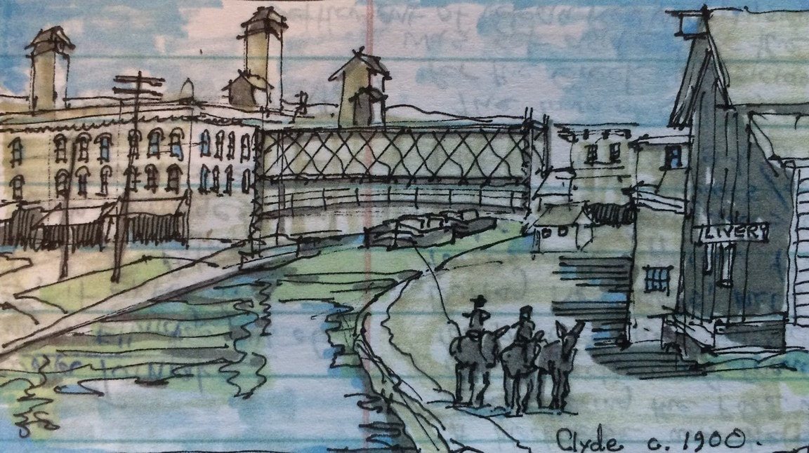 Clyde as it appeared around 1900 with canal boats passing beneath an open lift bridge. Clyde was settled in 1811 and named Lauraville in anticipation of our best friend Lora’s arrival aboard the Belle (just kidding of course!). A few years later, it was renamed Clyde by Scotsman Andrew McNab who also named the main business street Glasgow Street. The Erie Canal was built right through the settlement which became a bustling glass manufacturing center. When the Barge Canal was built in the early twentieth century, the old canal in town was abandoned and a new and larger channel was established a short distance to the south by straightening and dredging the Clyde River. There was a famous covered bridge over the river on Glasgow Street in the nineteenth century. We believe we observed one of its stone abutments as we continued our journey west. We continued along a heavily wooded stretch of canal interrupted by occasional and somewhat picturesque abandoned railroad bridge abutments festooned with grapevines and poison ivy. For about five miles, the canal parallels the old river with its tortured turns and loops which if traveled by boat would total ten or more miles. Shauna and Lora made soup and nachos for lunch. Soon, the village of Lyons came into view. Lyons was settled in 1789 at the fork of the head of the Clyde River where it was fed by the Canandaigua Outlet and the Ganargua or Mud Creek and named (tongue-in-cheek?) for the French city of Lyon at the fork of the Rhine and the Saone. Its French namesake seemed to have inspired architectural pretensions and the village subsequently developed a skyline with a domed courthouse, two substantial Gothic church towers with tall finials, and a three-story commercial block with a very fine wrought iron gallery at the corner. According to Rochester journalist Arch Merrill, 40 slaves were brought here from Maryland in 1797 to build a 1600 acre plantation for Daniel Dorsey complete with mansion and slave cabins. Lyons was established as the seat of Wayne County and its swampy lands became ideal for the culture of essential oils, particularly peppermint. Later in the nineteenth century, it became an important railroad town. The New York Central Railroad maintained car shops in Lyons until 1923. 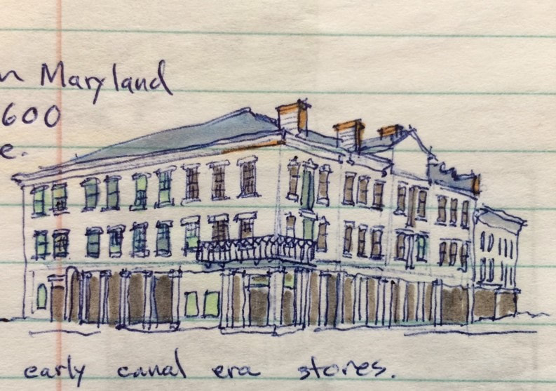 Erie Canal era stores in Lyons. We passed beneath the Geneva Street bridge and tied up on the wall near the approach to Lock E-27. The lock tender had already opened his gates to lock us up, so I called him on the radio to apologize and to let him know we were stopping in Lyons for a few hours. After connecting to shore power, we took a walk to the east side of town to visit the Trail of Hope. Aptly named, the serpentine trail and surrounding park were recently built by volunteers to offer children and the handicapped an opportunity to experience nature and to plant. We then walked into the town center where we visited the shops on William Street, got fresh coffee and searched unsuccessfully for some peppermint souvenirs. The Hotchkiss Essential Oils Company bottled peppermint oil here until about 20 years ago, shipping the concentrate in cobalt blue bottles and vials to candy and toothpaste manufacturers all over the world. One of their biggest customers was the Life Savers factory in Port Chester, NY, still decorated with larger-than-life peppermint Life Savers. The nineteenth century canal-side building has been preserved. 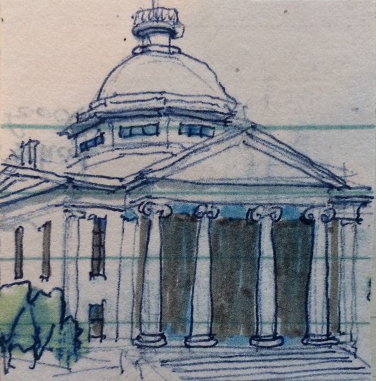 1854 Wayne County Courthouse We also went over to the courthouse square. One of the most sensational trials conducted in the Wayne County Courthouse was that of Oliver Curtis Perry who hijacked and robbed an express train in 1892 and made an escape by taking an idle locomotive away from the scene. He was chased, jumped off, stole a horse and sleigh, and then ran on foot. He was sentenced to 49 years, and later escaped from two prisons. The Utica Globe entitled its story of the trial “Startling Career, Desperate Deeds, Gifted Ruffian.” We returned to the Belle, and called the lock operator. He was at Lock E-28A and had to drive to E-27 to pass us west. After locking through, he drove back to E-28A to assist us there. Many lock operators manage two or more locks, shuttling between them by car or when close together by bicycle. Lock E-28A is located at the historic Lyons dry docks where canal tugs and barges are placed on blocks and repaired. Historic Dipper Dredge 3 sits in retirement here, a major artifact from the age of steam and the construction of the Barge Canal in the early twentieth century. The old “Poorhouse Lock” (old lock 56) from the 1840s is preserved here along with a brick canal store which is now a private residence. We could have spent at least an hour here, but the day was getting late and we were anxious to cover the few remaining miles to Newark. Several long freight trains ran parallel to the canal here and I was able to signal one in time for the engineer to blow the horn. We locked up through E-28B at the east end of Newark and docked on the wall in front of a village park with full boater services including showers and a laundromat. We had dinner at an Italian restaurant on Main Street. Back at the boat, Shauna baked cookies and we played a few rounds of Pictionary before calling it a night. AuthorMuddy Paddle grew up near the junction of the Hudson River and the Erie Canal. His deep interest in the canal goes back to childhood when a very elderly babysitter regaled him with stories about her childhood on the canal in the 1890s. Muddy spent his college years on the canal and spent many of his working years in a factory building overlooking the canal. Over the years he has traveled much of the canal system by boat and by bicycle. Muddy Paddle's Erie Canal adventure will return next Friday! To read other adventures by Muddy Paddle, see: Muddy Paddle: Able Seaman, about Muddy Paddle's adventures on the replica Half Moon, and Muddy Paddle's Excellent Adventure on the Hudson, about his canoe trip down the Hudson River.
The History Blog is supported by museum members and readers like you! Donate or join today! Editor’s Note: Welcome to the next episode in our 11-part account of Muddy Paddle's narrowboat trip through the Erie Canal and the Cayuga & Seneca Canal in western New York. The New York State Barge Canal system is in many ways a tributary of the Hudson River. It still connects the Great Lakes, the Finger Lakes, and Lake Champlain with the Atlantic Ocean by way of the Hudson River. Our contributing writer, Muddy Paddle, shares his experiences aboard the "Belle Mule." All the included illustrations are from his trip journal and sketchbooks. Day 4 - TuesdayLast night I paid our bill at the marina and told Captain Terry that I was planning to depart early in the morning by making a tricky three-point turn with the Belle. He didn’t like that plan at all, and later confided to the first mate that the Belle’s captain was “loco.” Brent tried to calm him down but It bothered him enough that when we woke up Tuesday morning, we found that the captain had relocated the big cruiser at our stern giving the Belle a clear exit to the gap in the breakwater. We shoved off under the good captain’s wary eye at 8:15 and shaped our course north along the east shore of the lake. We were hoping to get a nice view of Hector Falls, but we were in too close to the shore, and the falls were completely screened by topography and vegetation. 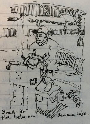 Our first mate steering with his feet tucked up on a cooler. We had a pleasant cruise down the lake with a gentle breeze at our back. As we reached Lodi Point, Brent fired up the gas grill and prepared barbecue pork chops for lunch. Brent loves to cook! The view from the helm consisted of the American flag at our mast, clouds of smoke rising from the bow, and intermittent appearances of our broadly grinning first mate, Brent. There were no boats out on the lake at all. It occurred to me that if we had mechanical trouble or worse, no help was readily available and that there were few access points given the steep banks rising up from the lake. It also occurred to someone on shore that our boat was on fire. A call was apparently made to one of the fine local fire departments. A couple of trucks appeared on the ridge to our east but returned to the station after apparently using binoculars or smelling our pork chops. We reached Geneva after lunch and it grew overcast as we re-entered the C&S Canal. Here we encountered kayakers and a replica of the steam launch African Queen. 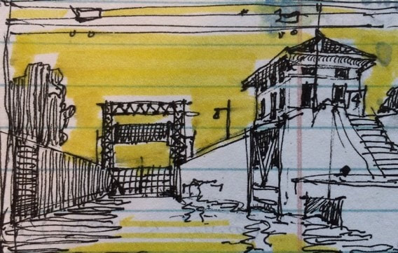 Lock 4 of the C&S Canal at Waterloo. Brent radioed Lock 4 when we saw the Waterloo water tower. The lock came up abruptly around a sharp bend in the canal. There was a heavy outflowing current bent on carrying us to the adjacent spillway where a rental company canalboat was stuck with emergency lines holding her in place. A breeze from the west didn’t help. We bumped our way into the lock chamber, crooked but safe. We were very grateful to have missed the rendezvous with the other boat and the spillway and even more grateful when the lock doors closed, blocking the breeze. Once again I was unable to keep the engine in neutral. The transmission would creep forward and then backward requiring constant adjustments. I tried using a boat hook to handle the hand line nearest the stern without leaving the pedestal, but once the boat gained any momentum, it was impossible. Brent held tight to his line in the bow, so the stern was always the first to go rogue. Once through the lock, we had a routine return to Seneca Falls and tied the boat up to the wall near the Heritage Area Center. The stranded canal boat was recovered from the edge of the spillway later in the afternoon and towed with her frightened occupants to the wall next to us. The renters were sputtering about the boat, the rental company and their “near death” experience at the spillway. They ended their trip in a rented Escalade after abandoning all of their provisions and all of their pride at our gangway. After cleaning, putting away the new food and making the Belle shipshape, we took ourselves on a walking tour of Seneca Falls. At Seneca Falls, a series of waterfalls and rapids created a barrier for west-bound travelers on the Seneca River. A portage was established in 1787 and mills took advantage of water power early in the 19th century. The Seneca & Cayuga Canal established locks here in 1818 and the connection between the two lakes and the Erie Canal was completed in 1825. Using abundant water power and the ability to ship materials by canal, Seneca Falls became a thriving mill town of four and five story mill buildings, foundries, housing, churches and stores employing thousands of laborers. It was against this background that Elizabeth Cady Stanton, Mary Ann McClintock and others organized the Women’s Rights Convention in 1848 at the Wesleyan Chapel on Fall Street. Central New York and the “burned over district” were primed for reform and advocates for abolition, women’s rights and Native Peoples’ rights had been recruiting in the area, especially among a branch of the local Quaker community. The convention, housed within a plain brick church, attracted both women and men and luminaries including Lucretia Mott and Frederick Douglass. It resulted in the publication of the Declaration of Sentiments, now recognized as a seminal moment in the history of human rights. The chapel building became many things after the Convention including, ironically, its final degradation as a decrepit laundromat. To interpret the building’s history after acquisition, the National Park Service initially deconstructed it to reveal only those materials that were original to it in 1848, leaving large sections of the top and sides open to the elements and accelerated deterioration. In 2010, the building was sensibly enclosed with new material where necessary in order to preserve the original walls and the surviving roof timbers.
We toured Fall Street, looked at the stores and restaurants, walked over to Elizabeth Candy Stanton’s house and finally sat to rest at a canal-side pavilion near Trinity Church. Lou, the boat owner’s representative, found us and gave us the unexpected but good news that the that the entire canal system would reopen tomorrow morning at 7:00 AM. We picked up a few supplies and had dinner at a pub on Fall St. It was dark when we returned to the boat. Lou staggered by for a visit after apparently spending a good part of the day at the American Legion. He stumbled on his way down the companionway steps and crashed flat on his face in the galley, blood trickling from his nose and mouth. We got him cleaned up and made him a cup of coffee before sending him home. We took power showers at the visitor center, checked our lines, and then called it a night. We will be entering the Erie Canal tomorrow! 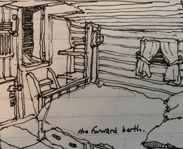 The forward berth aboard the Belle. AuthorMuddy Paddle grew up near the junction of the Hudson River and the Erie Canal. His deep interest in the canal goes back to childhood when a very elderly babysitter regaled him with stories about her childhood on the canal in the 1890s. Muddy spent his college years on the canal and spent many of his working years in a factory building overlooking the canal. Over the years he has traveled much of the canal system by boat and by bicycle. Muddy Paddle's Erie Canal adventure will return next Friday! To read other adventures by Muddy Paddle, see: Muddy Paddle: Able Seaman, about Muddy Paddle's adventures on the replica Half Moon, and Muddy Paddle's Excellent Adventure on the Hudson, about his canoe trip down the Hudson River.
The History Blog is supported by museum members and readers like you! Donate or join today! Editor’s Note: Welcome to the next episode in our 11-part account of Muddy Paddle's narrowboat trip through the Erie Canal and the Cayuga & Seneca Canal in western New York. The New York State Barge Canal system is in many ways a tributary of the Hudson River. It still connects the Great Lakes, the Finger Lakes, and Lake Champlain with the Atlantic Ocean by way of the Hudson River. Our contributing writer, Muddy Paddle, shares his experiences aboard the "Belle Mule." All the included illustrations are from his trip journal and sketchbooks. Day 3 - Monday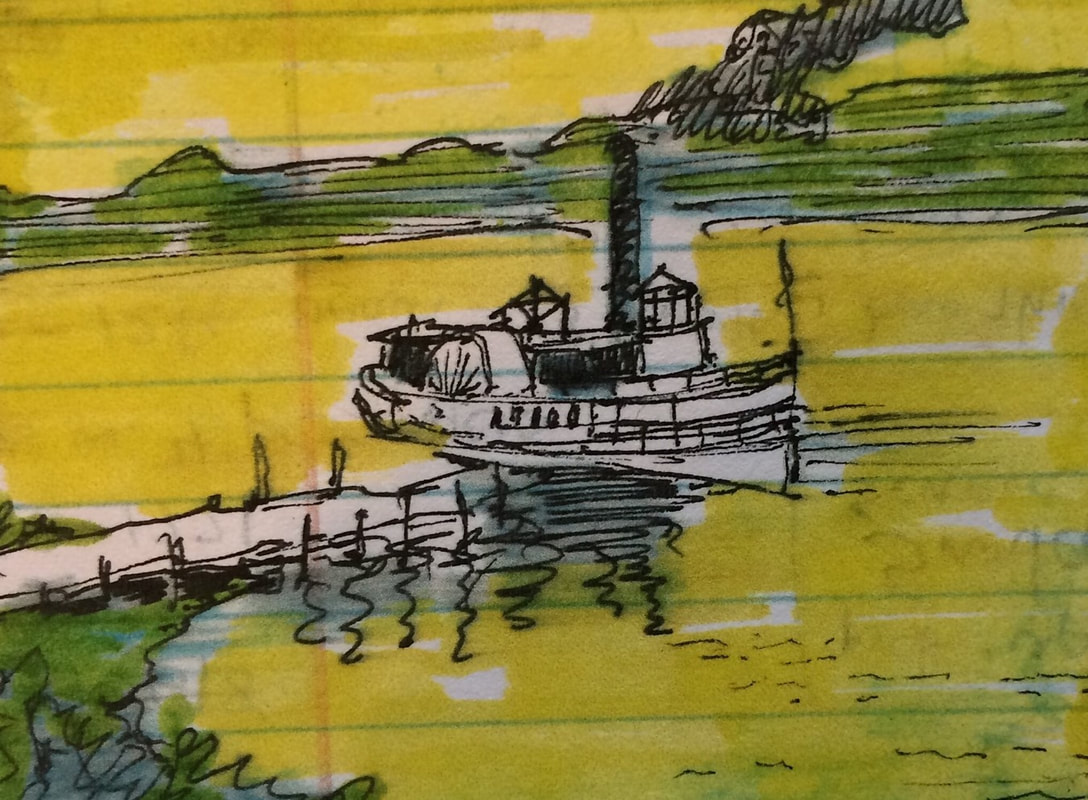 A typical finger lakes landing and a sidewheel steamboat with a walking beam engine in the nineteenth century. Nineteenth century photographs of Seneca Lake often echo similar scenes along the Hudson River. The long lake is surrounded by steep hills and its assortment of steamboats and canalboats look pretty familiar. The lake was also studded by large villas reminiscent of those on the Hudson and lakeside resorts. Commerce on the lake included the movement of coal and agricultural produce north to the Erie Canal and passenger steamers and ferries transited and criss-crossed the lake much as they did along the Hudson. I got up earlier than my mates and walked around the harbor at sunrise. There were a number of interesting and classic boats here including the excursion boat Seneca Legacy, the 1934 excursion boat Stroller, John Alden’s 1926 schooner Malabar VII and General Patton’s 1939 schooner When & If. I sketched vignettes of each and walked the shoreline in search of a souvenir. I recovered the neck of a green nineteenth century beer or soda bottle from a heap of dredge spoil as a talisman of Watkins Glen’s commercial past. Brent and I prepared bacon, eggs and toast in the galley and got caught on video doing a happy dance in front of the range. After cleaning up, we prepared picnic lunches, strapped on backpacks, and hiked to Watkins Glen State Park, about a mile south of the village. The park is one of the gems of the New York State park system and receives guests from around the world, many of them on tour buses heading to or from Niagara Falls. We encountered visitors from China, India and the Philippines. The centerpiece of the park is a two-mile gorge with 19 waterfalls and a precarious trail built on ledges, over stone bridges, through tunnels and up an endless series of steps and staircases. The park was established by a journalist in 1863 and acquired by New York State in 1935. A biblical flood in 1935 raised the water 80 feet deep midway through the gorge and within a few feet of a surviving bridge. Most of the stone-lined trail and bridges post-date this appalling flood. 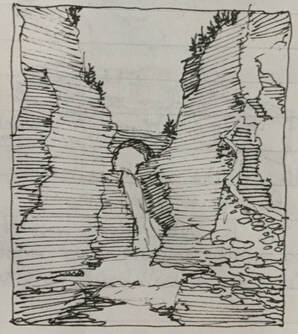 The gorge at Watkins Glen. The gorge at Watkins Glen. We reached the top of the gorge and had a pleasant picnic under the shade of a tree. It was 88 F. It was easier descending the gorge than climbing it, but it was a hot afternoon so we stopped for ice cream at the “Colonial” on Main Street. We returned to the boat and relaxed for about an hour. We bought some wine on Main Street for friends and had dinner at an Italian restaurant a few blocks south of the lake. Overhearing the conversations, it was apparent that many of the diners here were connected with auto racing and the Gand Prix in particular. After dinner we saw a micro-beer ad at the Chamber of Commerce. Shauna was determined to get some for our son but it was only sold in growlers at the brewery or at a liquor store south of the state park entrance. The brewery was closed so she took one of the bikes lashed to the cabin top and rode into the sunset. She arrived just after the store closed but somehow convinced an employee to let her in to purchase the beer anyway. She returned triumphantly an hour later with a bulging backpack! 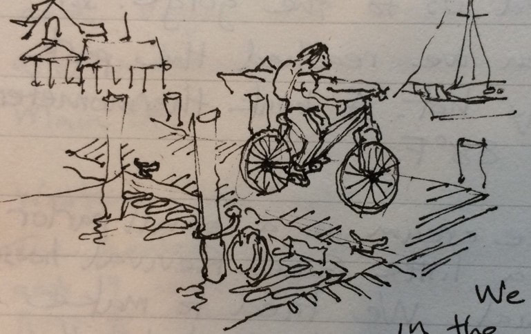 Shauna returning to the docks with the beer. We watched a comedy in the salon and enjoyed popcorn and chocolate. We called it a night at 11:00 PM and slept soundly on a calm and mild night. 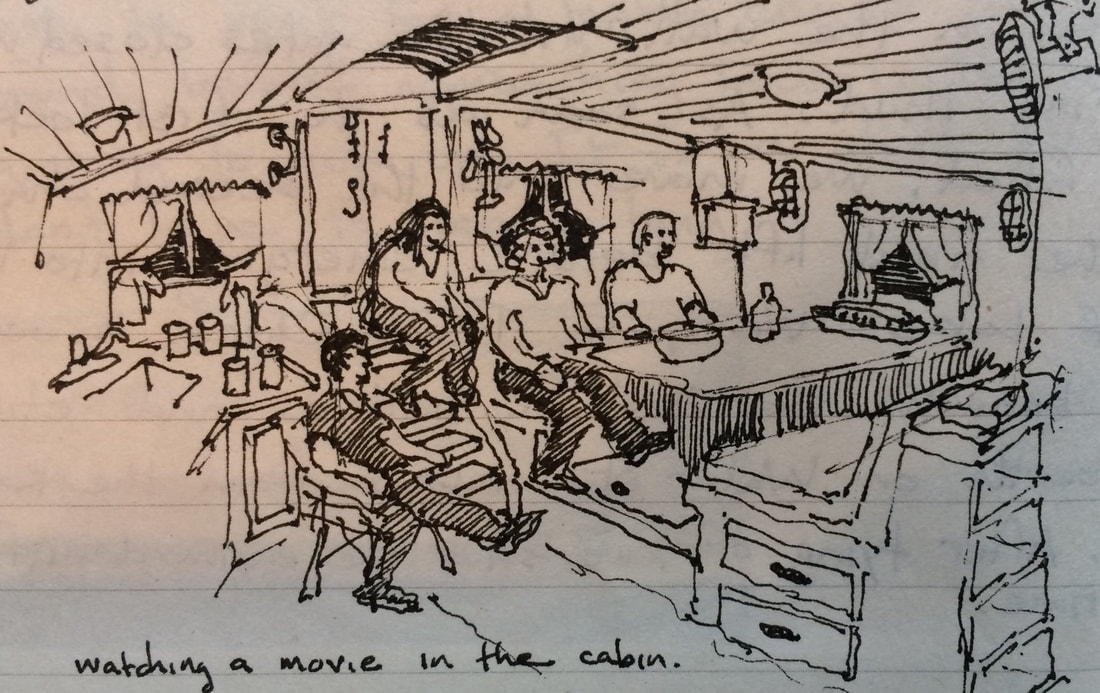 Movie and popcorn aboard the "Belle." AuthorMuddy Paddle grew up near the junction of the Hudson River and the Erie Canal. His deep interest in the canal goes back to childhood when a very elderly babysitter regaled him with stories about her childhood on the canal in the 1890s. Muddy spent his college years on the canal and spent many of his working years in a factory building overlooking the canal. Over the years he has traveled much of the canal system by boat and by bicycle. Muddy Paddle's Erie Canal adventure will return next Friday! To read other adventures by Muddy Paddle, see: Muddy Paddle: Able Seaman, about Muddy Paddle's adventures on the replica Half Moon, and Muddy Paddle's Excellent Adventure on the Hudson, about his canoe trip down the Hudson River.
The History Blog is supported by museum members and readers like you! Donate or join today! Editor’s Note: Welcome to the next episode in our 11-part account of Muddy Paddle's narrowboat trip through the Erie Canal and the Cayuga & Seneca Canal in western New York. The New York State Barge Canal system is in many ways a tributary of the Hudson River. It still connects the Great Lakes, the Finger Lakes, and Lake Champlain with the Atlantic Ocean by way of the Hudson River. Our contributing writer, Muddy Paddle, shares his experiences aboard the "Belle Mule." All the included illustrations are from his trip journal and sketchbooks. Day 2 - Sunday A canalboat taking on freight on the C&S Canal in the late nineteenth century. The Belle was comfortable for a boat of her size. The wood paneled cabins were warm and attractive, the layout was convenient and there was plenty of headroom. Shelving, cabinets and drawers used space efficiently and the window ports were dressed with curtains. A packet boat of the kind used on these canals before the Civil War would have been nearly twice as long, but would have carried dozens of passengers, segregated by gender and fit into bunks that could be folded away or otherwise removed during the day. Our boat cruises at about five or six miles per hour, only slightly better than its horse drawn predecessors. Mule drawn freight boats were slower.  A typical early nineteenth century canal packet boat. After an infusion of coffee, we cast off our lines and headed for Lock 4 and Seneca Lake beyond. Lock 4 is in the village and takes boats up to the lake level. We radioed the lock in advance of our approach and had a green light and open gates when we arrived. I got the boat lined up nicely on the right side of the lock chamber and put the shift into neutral so I could leave the pedestal and take hold of one of the hand lines to keep the boat parallel and next to the chamber wall. Brent did the same in the bow. We started having problems as soon as the doors closed behind us. First, the boat would begin to creep forward and Brent would yell that he couldn’t hold his line any more. I would go back to the pedestal, give the boat a few revolutions of reverse, go back to neutral and then run back to grab my line. But then the boat would creep backwards. She was living up to her name the Belle MULE!” I was grateful when the chamber was full and the gates opened at the upper end. We encountered a stiff current carrying excess lake water east over the spillway and had to use the bow thruster to remain on course. Two miles west, we stopped at a dock and walked up to Route 20 to visit the Scythe Tree, a local point of interest with a sad story. James Wyman Johnson enlisted in the Union Army in 1861 and left his scythe in the crotch a cottonwood tree near his family’s farmhouse. He asked that it remain there until his return. He died of battle wounds in a Confederate prison in Raleigh and never returned to the farm. The tree grew around the scythe. When the United States entered World War I, two brothers living on the farm, Ray and Lynn Schaffer, enlisted, placed their scythes in another crotch of the tree and found them embedded in the tree, when unlike Johnson, they returned safely. All three scythes remain in the big tree. We continued our cruise west into Seneca Lake and set a course for Belhurst Castle on the west shore of the lake below Geneva where we had made brunch reservations. However, we realized that it was getting late and a long brunch, not to mention the steep ascent up from the dock, would burn up hours and delay our efforts to reach Watkins Glen and find a berth. It was also beautiful weather, so we cancelled our reservations and continued our cruise, viewing the big Victorian house from half a mile out. We steered well clear of a sailboat race underway at the north end of the 36-mile long lake. In addition to its considerable length, Seneca Lake is also more than 600 feet deep and littered with the wrecks of dozens of canalboats, steamboats and other craft from its long history of use. Many of these went down in bad weather and as a result of accidents (maybe this is why the boat rental companies prohibit their canalboats from venturing out onto the lakes….). Others were scuttled here at the end of the animal powered canal era. One of the best wrecks for divers to visit is located along our course below Geneva in Glass Factory Bay at a depth of about 115 feet. Unfortunately, visiting divers were careless some years earlier and dragged an anchor through the intact canalboat, carrying its lightly framed cabin top off the boat and over the side. 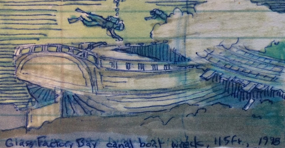 Canalboat wreck at a depth of 115 feet in Glass Factory Bay. Traveling south at about six miles per hour, we reached the power plant near Dresden late in the morning and the Navy training platform in the center of the lake around 1:00 PM. The derrick-studded platform is now leased as a research facility but some years ago it represented the center of a highly classified experimental submarine warfare station and was heavily guarded by armed sentries and patrol boats. Shauna and Lora relaxed and soaked up the sun in lawn chairs set up in the bow. Women passengers aboard the packet boats were similarly offered chairs in the bow to enjoy their journeys. Watkins Glen is located at the south end of Seneca Lake and we began making calls and using the radio in an effort to find a berth for the Belle. The most likely facility was Village Marina but we were unable to make contact. After passing several very large cruising sloops and a schooner we arrived at a rip rap breakwater protecting the marina. The radio crackled and we were told to switch to channel 66. Once there, Captain Terry, the marina manager, told us that he had a berth available. He sounded agitated. He told us to enter the basin between two drunken pilings; turn sharply right and then approach the T-dock “under spirits.” As we entered, we could see that there was very little space to maneuver and that there were plenty of big and expensive fiberglass cruisers to stay clear of. I threw the transmission into reverse to kill our momentum, spun the wheel to starboard and then crawled forward. A crowd emerged outside of the bar to watch the expected pile-up. We could see that we would need to parallel park because there was no room to turn the Belle around. A gentle breeze helped us line up and a bystander threw us a line at exactly the right moment. We made a clean landing, secured our lines and shut down the engine. A greeting committee gathered with drinks for us and we felt obliged to graciously open up the boat to them to satisfy their curiosity. One woman on her fourth martini made herself at home in the salon where she held court. Captain Terry raced in from the lake to see if we had done any damage to the expensive boats or the docks. Seeing that we were well secured and seemingly accepted at the marina, he relaxed a little and explained that hire boats like ours make him nervous. A similar boat crashed and sank on the inside of the stone breakwater in a previous year. Recalling the incident, he said, “you know a guy is in trouble when you see his wife yelling at him, his daughter tugging on him and his mother-in-law giving him instructions as he tries to dock a big boat.”  The "Belle" maneuvers into the marina under the gaze of the customers at the bar hoping to see an accident. After tidying up and gently asking Mrs. Martini to leave, we walked into Watkins Glen, explored Main St, and got bad directions to Walmart where we planned to buy groceries and ice. We returned to boat much more directly using a shortcut along the railroad tracks. Brent found that our grille had no gas, so he made a second trip to Walmart to get some so that he could grill chicken for dinner on the bow. Shauna and Lora prepared salads and rice in the galley. We set up folding chairs on the cabin top and had a relaxing dinner as the sun set. Sailing cruisers and an excursion boat sailed in and out of of the harbor with red and green running lights as it got darker. We retired to the cabin for a spirited game of Pictionary and fell asleep quickly as the sea gulls squealed overhead. We slept restfully as the Belle swayed gently to the lake swells. AuthorMuddy Paddle grew up near the junction of the Hudson River and the Erie Canal. His deep interest in the canal goes back to childhood when a very elderly babysitter regaled him with stories about her childhood on the canal in the 1890s. Muddy spent his college years on the canal and spent many of his working years in a factory building overlooking the canal. Over the years he has traveled much of the canal system by boat and by bicycle. Muddy Paddle's Erie Canal adventure will return next Friday! To read other adventures by Muddy Paddle, see: Muddy Paddle: Able Seaman, about Muddy Paddle's adventures on the replica Half Moon, and Muddy Paddle's Excellent Adventure on the Hudson, about his canoe trip down the Hudson River.
The History Blog is supported by museum members and readers like you! Donate or join today! Editor’s Note: The New York State Barge Canal system is in many ways a tributary of the Hudson River. Initiated in the early nineteenth century and reinvented in the early twentieth century, New York State’s canals are part of an integrated waterway linking the Great Lakes, Lake Champlain and the Finger Lakes with the Atlantic Ocean by way of the Hudson River. The nineteenth century development of the Hudson River Valley including its expanding cities and canalboat tows is inextricably linked to the history of these canals. Our contributing writer, Muddy Paddle, has previously shared his adventures on the Hudson by canoe, and aboard the Half Moon. He loved boating, but as he reached retirement age, long distance paddling and its lack of creature comforts became a little less appealing. A narrow boat canal adventure was exactly what was needed. Muddy went to college along the canal and during his working years maintained many connections to the canal and its communities. Touring the canal in a comfortable boat with a dry cabin and a well-equipped galley was very appealing. His wife and best friends would join him. All the included illustrations are from Muddy Paddle’s sketchbooks.  The narrow boat "Belle Mule" at the dock in Seneca Falls. There are several excellent canalboat rental outfits but Muddy selected a well-worn narrow boat from a private owner for this trip. He and his crew members picked up the boat on the Cayuga and Seneca Canal in Seneca Falls and planned to travel north to the junction with the Erie at May’s Point and then west on the Erie to Buffalo. The all steel Belle Mule was a retired hire boat measuring 46 feet in length, 12 feet in beam and a draft of about 3.5 feet. She featured a virtually flat bottom with a rounded bow and stern. Her cabin was built of steel and contained a galley and salon at the after end and two compartments forward, each with a head, and bunks for four. She had been designed to recall the shape of a nineteenth century horse-drawn packet boat. The Belle was powered by a Yanmar diesel beneath the quarterdeck and a bow thruster for help in docking in tight quarters. She carried a pedestal helm with a steering wheel and engine controls. The quarterdeck was protected from rain and sun by a canvas canopy. A marine radio was carried under the canopy with the microphone hanging directly above the helm. The weather was terrible for the the entire week before Muddy’s departure and rainwater flooded the Erie throughout central New York. The Finger Lakes were over their banks flooding Penn Yan and discharging millions of gallons of water into the Seneca River and other feeders of the canal including the Clyde River. An advisory was issued temporarily closing the Erie but allowing the Cayuga and Seneca to remain open. So Muddy changed the itinerary to explore the Finger Lakes in hopes that the Erie would re-open later in the week, which it did. His illustrated account of the adventure, taken from his on-board journal, is presented in the following pages. 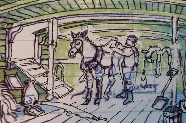 Harnessing up aboard a canalboat in the nineteenth century. Sketch inspired by Peter Spier illustration in Erie Canal, 1970. Day 1 - SaturdayWe sailed to Seneca Falls aboard Brent’s Silverado. The bed of the truck was filled will gear and provisions and the hatch was covered with a tarp due to the never-ending rain. The weather improved as we plotted our final approach to the village. Arriving at the Water St bulkhead, we met the boat owner’s representative, Lou. Lou turned over the keys and we took the boat out for a brief shakedown cruise on Lake Van Cleef to get acquainted with her operation and handling. Lake Van Cleef is a product of the early twentieth century Barge Canal. The falls on the Seneca River, and the stone locks carrying boats around the falls were dammed and flooded in 1915 to create two massive concrete locks with a combined 42-foot drop and an adjacent hydroelectric plant. Many of the water-powered factories in Seneca Falls were demolished in preparation for the flooding and the character of the village was forever changed. The old Cayuga and Seneca Canal locks and building foundations remain intact at the bottom of the lake. We had a nice ten-minute cruise before returning to the wall, moving our gear aboard and then berthing the truck at a village lot. 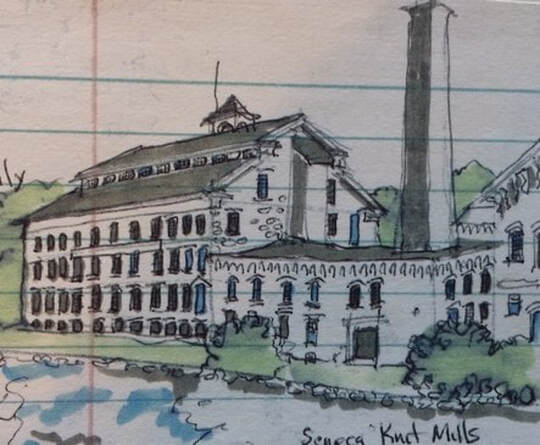 1844 mill on the C&S Canal in Seneca Falls. The mill is now the home of the National Women's Hall of Fame. After getting the boat settled, we motored under the George Bailey bridge (Seneca Falls is said to have been the inspiration for Bedford Falls in the Jimmy Stewart film “It’s a Wonderful Life”) and continued several miles west on the C&S Canal to Waterloo to take in Memorial Day weekend celebrations. Founded on the site of a Cayuga village destroyed during the American Revolution, Waterloo was settled in the 1790s, named “New Hudson” in 1807 and then re-named “Waterloo” in 1816 in commemoration of Napoleon’s 1815 defeat. The village retains fine early nineteenth century houses and later nineteenth century commercial blocks. Waterloo bills itself as the birthplace of Memorial Day, first celebrated here in 1866. At Lafayette Park, we found an enormous display of flags, food vendors, and bands playing country, swing and rock. A tribute rock band belted out Judas Priest and AC/DC and a country band performed “Sentimental Journey.” We visited a Civil War re-enactment camp and listened to the Erie Canal song accompanied by guitar. The “Erie Canal” song was tamed and published by Thomas Allen as “Low Bridge, Everybody Down” in 1905, but earlier versions referenced the darker side of life along the canal. One of the many folk stanzas still circulating at the time the song got cleaned up referred to Sal as an alcoholic cook who “died in sin, and had too much gin; ain’t no bar where she didn’t go, from Albany to Buffalo.” We had a food truck dinner at the park and returned to the Belle for the evening where we watched fireworks above the village from the cabin top. Lou stopped by before we turned-in for the evening and asked us if we wanted to go out for a few beers. Brent lied and said that he was an 67 and “too old for that kind of nonsense.” 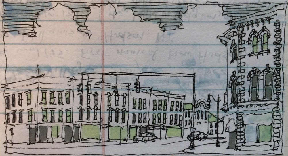 Main Street, Waterloo. AuthorMuddy Paddle grew up near the junction of the Hudson River and the Erie Canal. His deep interest in the canal goes back to childhood when a very elderly babysitter regaled him with stories about her childhood on the canal in the 1890s. Muddy spent his college years on the canal and spent many of his working years in a factory building overlooking the canal. Over the years he has traveled much of the canal system by boat and by bicycle. Muddy Paddle's Erie Canal adventure will return next Friday! To read other adventures by Muddy Paddle, see: Muddy Paddle: Able Seaman, about Muddy Paddle's adventures on the replica Half Moon, and Muddy Paddle's Excellent Adventure on the Hudson, about his canoe trip down the Hudson River.
The History Blog is supported by museum members and readers like you! Donate or join today! Editor’s Note: The replica ship Half Moon was completed in Albany in 1989 and served as a cultural ambassador celebrating the role of the Dutch in naval architecture, exploration, international trade, and colonization. An earlier replica was built in Amsterdam and presented to the United States during the Hudson-Fulton Celebration in 1909. This first replica was not maintained after the celebration and did not survive long as a static exhibit at Bear Mountain and later at Cohoes. The 1989 replica performed well once her characteristics were understood and was exhibited in a number of ports along the Atlantic seaboard. Later, she served as valuable and successful educational platform on the Hudson River through her “Voyages of Discovery” program for school children. The ship is currently in the Netherlands after spending several years as an exhibit in Hoorn. To read more about the technology and terminology of sailing in the seventeenth century and later, John Harland’s Seamanship in the Age of Sail, 1984 (republished by the Naval Institute Press in 1987) is recommended. For an account of Henry Hudson’s four voyages of exploration, including his trip up the Hudson River in 1609, Donald Johnson’s Charting the Sea of Darkness, International Marine, 1993 is recommended. This latter book is dedicated to the shipwright who designed and built the replica, Nick Benton. Follow Muddy Paddle, Able Seaman aboard the replica ship Half Moon here. Anchoring and lowering the topmasts in Delaware Bay We assigned pairs to a series of one-hour anchor watches for the evening to make sure that our anchor held and to quickly identify any other potential emergencies. At midnight, the wind was really howling and the ship heeled over alarmingly several times, bringing a few others including feline crewmember Mrs. Freeboard up on deck. The anchor held, and by 4:00 AM, the wind subsided and the stars came out. After a hearty breakfast, we set about the task of lowering our topmasts and topgallant poles so that we could take the ship into Wilmington later in the day. We underestimated the difficulty of accomplishing this at anchor with inexperienced volunteers. Taking each mast in turn, the plan was to attach a line to the topmast heel, pass it over the grooved mast cap and run it aft to a fife rail where a snatch block was rigged to direct the line to the capstan (a big rotating drum turned by handspikes or bars and used for heavy work). The crew would man the bars, take the strain and lift the topmast an inch so that the fid piece securing it could be knocked out. The crew would then gently walk the capstan backward until the crosstrees were in the tops. 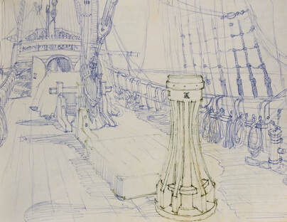 Illustration of the capstan at the main deck. Illustration by Muddy Paddle. It was a sound plan. We began with the foretopmast. As soon as the strain came on the line, the wooden block at the fiferail shattered and the mast jumped down a good distance before the capstan took the shock. A small piece of the block’s wooden shell dropped harmlessly to the deck while the larger chunk whistled off at 100 mph toward New Castle. Fortunately the capstan and the crew held. The mast was lowered the remainder of the way without the block. The maintopmast proved to be a bigger challenge. We used a modern steel block for this episode. When the bars were manned, Mike knocked out the fid block, and we lowered the topmast down several feet where we discovered that it was unable to drop clear of the main yard. We secured the line and rigged tyes (safety lines) to the yard in preparation for lowering. It would not budge. The yard had not been shifted since installation in Albany, and the necklace, securing it to the mast was now thoroughly infused with varnish. I had to harness up, cut some of the seizings, and then jump on the yard to get it to move. After getting Mike on the yard with me and spraying WD 40 on everything, we were able to work the yard down far enough for the topmast to drop into position well below the point where the topmast would drop. 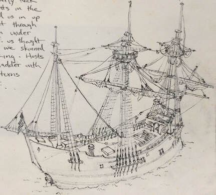 The Half Moon’s masts and yards lowered and ready to enter the Christiana Creek. Illustration by Muddy Paddle. The next challenge was recovering our anchor so that we could get underway. We motored up to the anchor, pulling in the heavy cable along the way until we were “up-and-down,” that is the cable was now vertical between the hawse hole in the bow and the anchor down below. We attached a messenger line to the cable and led it back to the capstan. We manned the bars but the anchor was apparently buried deep in the mud. Last night’s high winds were surely a factor in burying the anchor so securely. We had to wait for slack tide before we could successfully bring it up. We were going to be late for the grand arrival. It was dark when we entered the Christiana Creek leading into the Wilmington waterfront and our running lights failed. We sent the first mate out in the dink with a flashlight to find the way to our dock. He returned and led the ship there with his flashlight. We cleared a highway bridge with inches to spare, and had difficulty docking in the dark. The crowd that had planned to greet us was gone and all that remained were a few organizers and some warm beers. Afterword After a day in Wilmington, the Half Moon continued south to Washington, D.C. I had to get back to work and took the next train home to New York. Returning from Washington, tugboat captain Chip Reynolds came aboard. He took command of the ship during the return voyage and began a long and distinguished association with the ship marked by a much needed emphasis on safety. Countless school children sailed with the Half Moon on educational “voyages of discovery” between New York and Albany, and many of the lessons were filmed live to home classrooms by Skype. Reynolds had a crew of schoolchildren aboard the Half Moon in New York harbor when the planes were flown into the two towers of the World Trade Center in 2001. He kept everyone calm, and brought the children safely up the river where they could be reunited with family. I joined the ship one last time in 2006 at the end of the sailing season to bring the ship to her winter berth in Verplank. We sailed much of that distance before a stiff and cold northwest wind. It was an exhilarating experience as we raced down the river between the Catskills and the Highlands during peak autumn color. 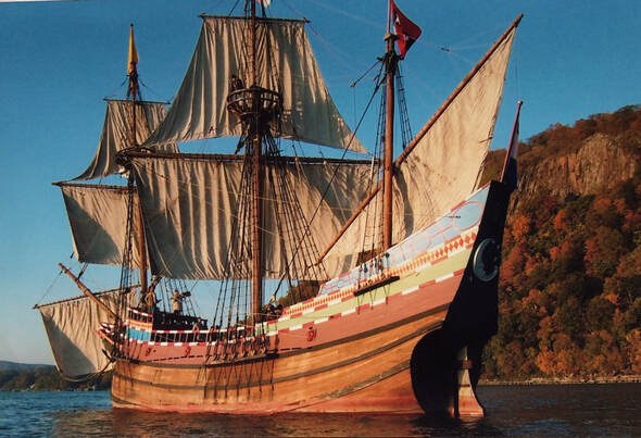 The "Half Moon" sailing down the Hudson River in 2006. Photograph by Muddy Paddle. In 2015, the voyages of discovery were suspended, Captain Reynolds was discharged and the Half Moon was sent to the Netherlands, arriving in August. She then proceeded to the Westfries Ship Museum in Hoorn where she was exhibited. There has been discussion about returning the ship to the United States in the near future but to date, no specific plan has been announced.  Shipwrights Nick Benton and Nicholas Miller addressing the ship’s builders in 1989. Photograph by Muddy Paddle. Building and sailing replica ships offers rare insight into worlds which no longer exist. Design details that at first seem frivolous or impractical are often revealed to make perfect sense as construction proceeds or as experience is gained operating the ship. Replicas help us to understand that our ancestors were not only daring and courageous, but equally ingenious and practical. Getting kids involved in these projects offers lessons in discipline, leadership and self-confidence and is a sure way to cultivate a deep appreciation for our maritime heritage. Thank you, Muddy Paddle, for sharing these adventures! AuthorMuddy Paddle grew up near the Hudson River and always loved ships and boats. A job change in 1988 brought him to an office near the site where the Half Moon was being built and he became involved as a volunteer. Muddy learned the ways of seventeenth century sailing and accompanied the replica ship on a series of adventures and misadventures on the river, in New York Harbor and even offshore. He maintained a journal, which served as a reference for on-board terminology and operations as well as a place to record a few highlights of his trips. The accounts presented here, and several of the illustrations, were based on this journal and his recollection of these trips. If you enjoyed this post and would like to support more history blog content, please make a donation to the Hudson River Maritime Museum or become a member today!
|
AuthorThis blog is written by Hudson River Maritime Museum staff, volunteers and guest contributors. Archives
May 2024
Categories
All
|
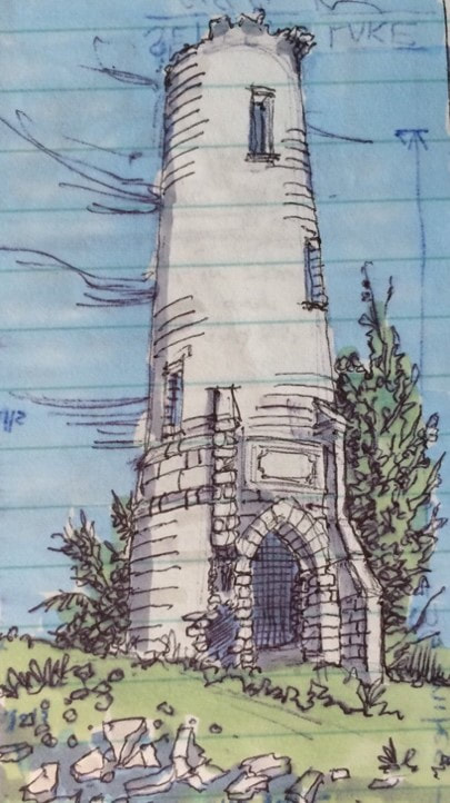
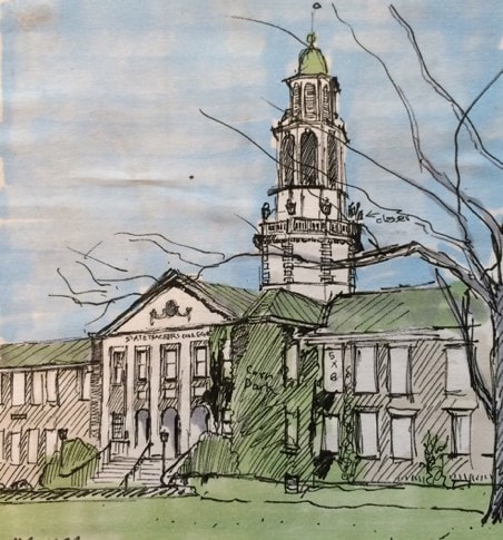
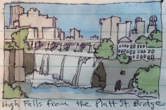
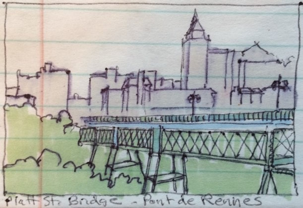
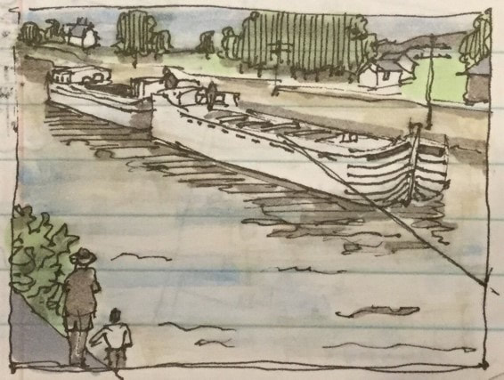
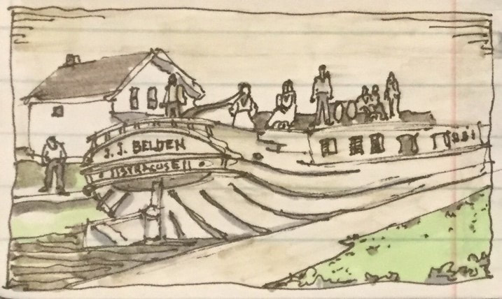
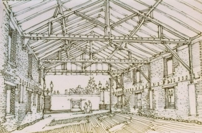
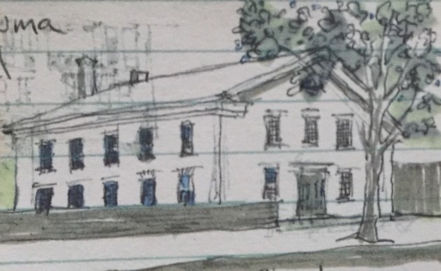
 RSS Feed